Home | Session 4 | Watersheds Pg 1, 2, 3
Watersheds
Presented
by Ellen Metzger
San Jose State University and BAESI
Click to view the key to discussion questions
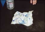
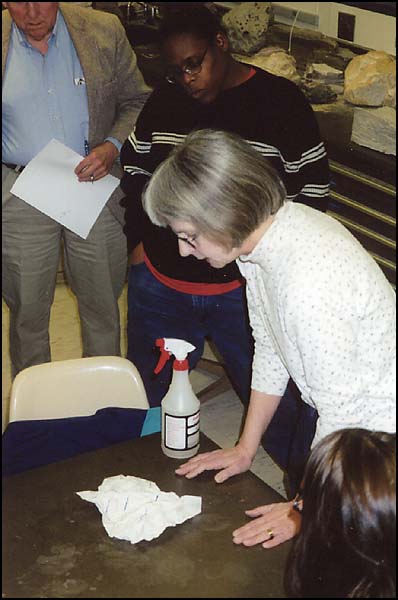
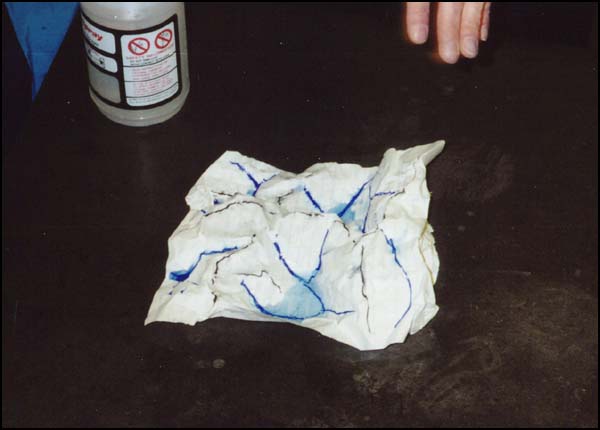
- A Paper Model of a Watershed (adapted from the Project WET activity "Branching Out")
Materials
8.5 x 11 inch sheet of paper
Water-soluble markers
Spray bottle
Sponges/paper towels for clean upProcedure
Crumple a sheet of paper into a ball.
- Open the paper gently, but don't flatten it out.
- Use a brown or black marker to trace the highest points on the paper (the "ridges").
- Use a blue marker to mark where creeks, rivers, lakes, and bays might be.
- Use another color of marker to show four or five places where buildings such as houses and schools might be located.
- Predict where rain falling on several different spots on the map will go.
Questions for Class Discussion
- What happened to the water that fell on the ridge tops?
- Where any of the buildings you drew in the path of the water?
How does flow of water though a watershed affect the choice of building sites?
- How might pollutants near the top of the watershed affect the quality of water in the lower parts of the watershed?
updated March 4, 2002
UCMP Home | What's new | About UCMP | History of Life | Collections | Subway
![]()