Hunting for Mesozoic vertebrates in Ethiopia: Field notes from Mark Goodwin
By UCMP assistant director Mark Goodwin, January 22–26, 2008
January 22, 2008
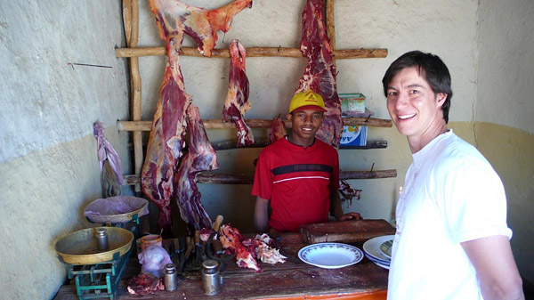
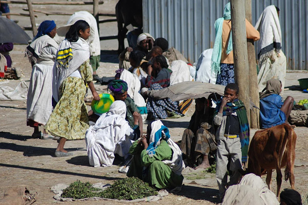
We spend the morning in Alem Ketema. It's a local market day and there are a lot of people around in the town square, some buying, some selling. We purchase onions, tomatoes, bananas, and eggs for tomorrow's breakfast. Nearby is a butcher shop — Greg stops in to see what's fresh. Everything's fresh … and you can eat in or take out at the raw bar. We decide to have pasta tonight and move on to the square and visit the local church.
When I was here about 10 years ago, I noticed some fossil leaves in the foundation stones of the church. Apparently, the foundation has been upgraded since that time because the fossil leaves are nowhere to be found, however, we do find some leaf and stem impressions and petrified wood within the building stones of other buildings surrounding the square. We decide to look for the locality later in the morning.
|
|
|
|
| Click on any photo on this page to see an enlargement. Left: Raw meat is standard fare in Ethiopia and you can choose your cut and eat in or take out. Greg ponders what to buy. Right: It's market day in Alem Ketema. Vendors sit on their blankets with their fresh fruit, vegetables, and grains in the main square. | ||
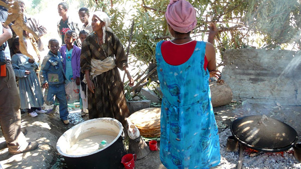
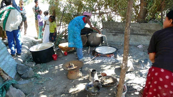
Before leaving the town square, we stop at a house next to the church where a group of women are making injera, a large pancake-shaped spongy "crepe" made from tef, a grain that is unique to Ethiopia. Tef is the only grain to contain a symbiotic yeast, so no additional yeast is needed in the injera batter. The tef mixture is fermented for up to three days before the batter is cooked on a stone over hot coals (see photos below). Just in case you were wondering, there are electric injera makers being marketed in the larger cities.
 |
 |
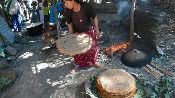 |
| Left: The vat of fermented tef is ready to be poured onto a hot stone. A pile of fresh injera can be seen in the middle of the photo. Center: The injera mixture bubbles and froths as it is carefully poured onto the hot stone. Right: Warm injera is stacked as the assembly line process continues … and it's good too: warm, spongy, and slightly sour. | ||
On the outskirts of town, we investigate some exposures of interbedded, white volcaniclastic sediments (layers rich in volcanic ash) within the plateau-capping basalts. We discover leaf and stem impressions in some layers of these fine-grained sediments; fossil wood and tree trunks too. Is this where Alem Ketema gets the stone for its buildings?
 |
 |
|
 |
 |
|
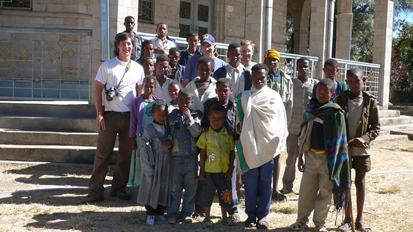
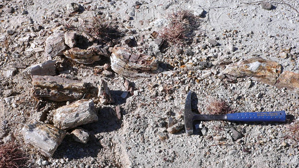
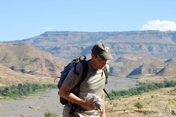
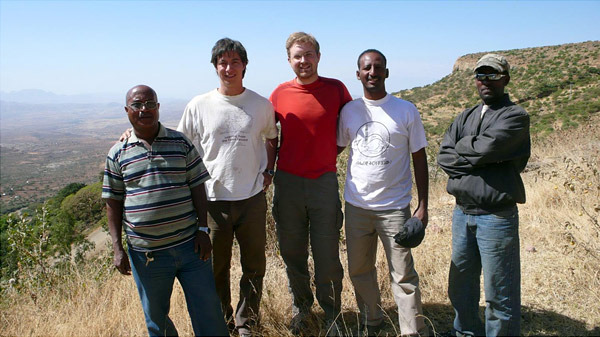
| Top left: A group photo is taken at the church before we leave the main square and get some work done in the field. Top right: Randy prospects over the bright white volcanic rocks looking for fossil leaves. Bottom left: Greg points to a fossilized tree trunk weathering out on the surface. The pieces are well mineralized and look like typical fossil wood. Bottom right: A close up of the permineralized fossil wood. Most of the tree trunk remains buried in the sediment, slowly weathering out. | ||
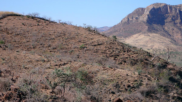
Our next field stop today is a series of exposures north of Alem Ketema that overlook the Wenchit and Besola Rivers. The surrounding scenery is impressive with incredible vertical relief and some pretty good reddish beds of the Mugher Mudstone to prospect. We pick up a lot of weathered turtle, fish, and crocodilian bone on the surface and trace it to the levels where it originated. This increases our chances of uncovering some articulated bones. As luck would have it, I find some! These are the first articulated bones found in the Mugher Mudstone at this locality: a series of vertebrae from what appears to be a goniopholid crocodile, though I'd love to make a dinosaur out of it. A more definitive identification will have to wait until we can borrow these fossils, prepare them, and do some comparisons with bones from other animals found both here and in Europe, from sediments of the same age.
 |
 |
|
 |
 |
|
| Top left: That's Greg in the middle of the picture, prospecting for vertebrate fossils. Top right: A view to the east showing the confluence of the Wenchit and Besola Rivers. All the low-lying reddish-gray exposures are the Mugher Mudstone. It's the dry season now so there is little water in the wide, meandering river valley. Bottom left: It never takes very long for children to find us. Here, our local assistants scour the surface, helping us spot "float" bones of crocodiles, turtles, and fish that have weathered out. Acacia trees provide little shade and lots of thorns. Bottom right: Randy leaves the outcrop with a bag containing the associated bones of a turtle. | ||
January 23, 2008
We leave Alem Ketema in the morning and head north. We are required to stop in the Ministry of Tourism office in Bahir Dar, along the south shore of Lake Tana, before continuing our field work in Tigrai Province. Normally, we would have completed this prior to working in Alem Ketema as Bahir Dar is the home of the regional government office overseeing our work in this region. Because of the distances involved, we decided to delay this until we completed our work in the Mugher Mudstone. I'm pleased with how everything has gone — we accomplished our goals of georeferencing previously known fossil localities, we collected over a half ton of sediment from the mammal locality JEM VP-5 (see previous update), and found new sites and new fossils.
 |
 |
|
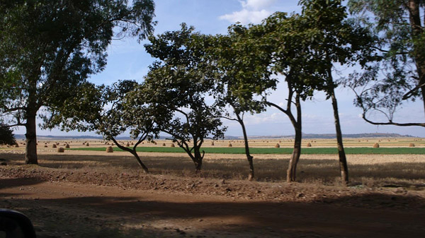
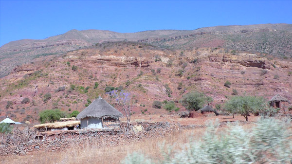
| Left: Caution, steer crossing. Leaving the Jema River valley and its basalt-capped cliffs behind, we make our way west. Right: Back on the plateau in the Federal region of Oromia, thatched tookles and small family farms border either side of the road throughout the countryside. Fertile fields have been harvested and the cut grain is separated from the chaff using oxen. | ||
We stop to stretch our legs and discover that one of the tires on Abdi's Landcuiser is almost flat. While we change the tire, we're suddenly surrounded by a group of curious children — they must be from a nearby village and school has just let out. It seems that whenever we stop, local school children are often the first to greet us. They all want to practice their English. When we're just passing through a town, shouts of "faranji, faranji" (=foreigner) can be non-stop.
 |
 |
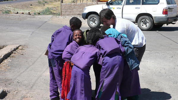 |
| Left: Considering some of the road conditions and all the miles we're putting on the Landcruisers, a flat tire comes as no surprise, but such incidents may prevent us from reaching Bahir Dar today. Center: A group of local high school students stop by to say hello to Chalachew and Randy while we change our flat tire. Their notebooks are filled with English language lessons and completed math assignments. Right: Digital cameras always draw a crowd. During a stop for diesel, Greg shows the kids their picture in his camera. The kids often ask if they can have a "copy." | ||
We push on past Debre Libanos, a very important town historically. Debre Libanos was the center of the Ethiopian Church for four centuries prior to a brutal massacre of monks and lay people initiated by fascist soldiers during the Italian occupation in 1937. The monastery was destroyed and the town never recovered as the center of learning that it used to be. Today, a modern church sits on the edge of the canyon whose steep sides are terraced with cultivated fields.
 |
 |
|
| Left: A steep overlook and switchbacks lead down to the bridge over the Blue Nile River at the bottom of the gorge. The town of Dejen lies ahead. Right: Green fields lie between fallow and recently harvested tracts along the road. Significant rainfall and rich volcanic soil contribute to the fertile countryside as far as we can see. | ||
We drive until dark but find ourselves some 200 km south of our destination, Bahir Dar. We spend the night in the small town of Funetsalem. Pleasant accommodations are had at the Extreme Hotel and we settle in for the night after a long day of driving.
January 24, 2008
We hit the road at 6:00 am and finally make it to Bahir Dar, on the south shore of Lake Tana, to take care of administrative business. We meet with Wagaw Hailu, head of the Amhara Regional State's Department of Culture and Tourism. The meeting is productive and Wagaw is very supportive of our field research and interested in what we are finding and future plans. After about an hour, we head into the main square of Bahir Dar where Teshome and Abdi find a garage where they can take the Landcruisers for some minor repairs, and we find an internet cafe and brunch. The internet connection is excruciatingly slow and often interrupted, which makes for sending e-mail and this report a frustrating experience … and in the end, impossible. We pick up some supplies, groceries, and bottled water for the long ride east to Mekelle.
 |
 |
|
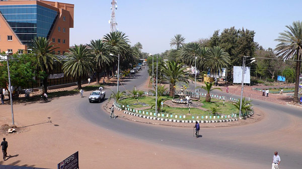
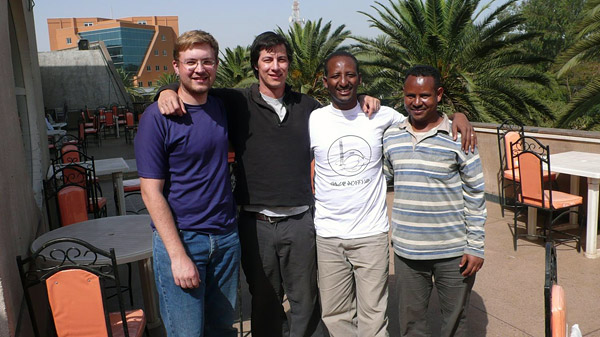
| Left: The main square of Bahir Dar is surrounded by palm trees and has a distinctly tropical, almost sticky, feel to it. The Blue Nile River begins it's journey here, flowing southeast, then west, and finally northwest until it joins the White Nile at Khartoum in The Sudan. There are many 14th-century monasteries, some possibly older, along the shore of Lake Tana, but unfortunately we don't have time to be tourists today. Right: Randy and Greg join Chalachew and his former classmate from Addis Ababa University, now a high school teacher in Bahir Dar, for a quick picture before we hit the road again. | ||
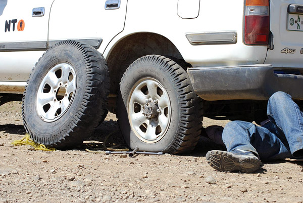
We have a choice: drive north to Adigrat and around to Mekelle, or head east to Woldiya, then enter Mekelle from the south. We decide on the latter plan. Mistake! Little did we know that the road Teshome selects is barely passable and under construction for most of the way. A 12-hour day of bone-jarring roads, dodging road construction equipment, negotiating detours, flat tires, and eating dust (literally) gets us only to the outpost of Filaket, far short of our goal of Woldiya. We pull off the road and spend the night in a small "rustic" compound as it becomes impossible to drive any further east with darkness falling. But, hey, they have satellite TV, cold beer, and tibs. We're tired and sore and head to bed after dinner.
 |
 |
|
| Left: The sign gives us a choice of routes … but we choose badly. After about 50 kms, the road deteriorates and becomes barely passable. Our speed is reduced to a crawl for most of the day. Woldiya is only 300 km away (as the crow flies) but it feels like we'll never get there … and we don't, today. Right: We push ahead, slowly meandering through small villages and towns, on a temporary road parallel to what will eventually be a new, nicely paved road. | ||
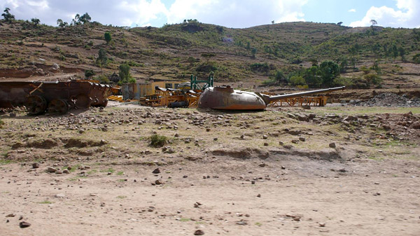
A little more Ethiopia history: Mengistu Haile Maryam, leader of the Derg, a committee of low-ranking military officers and enlisted men set up to investigate the military's grievances and abuses, was responsible for the overthrow of Haile Selassie in the 1974 revolution. Mengistu, who became military dictator, was removed from power in 1991 by two rebel movements, the Ethiopian People's Revolutionary Democratic Front (EPRDF) and the Eritrean People's Liberation Front (EPLF). In 1994, Ethiopia adopted a new federal constitution and parliamentarian government, led since then by Prime Minister Meles Zenawi.
 |
 |
|
 |
 |
|
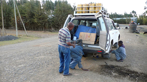
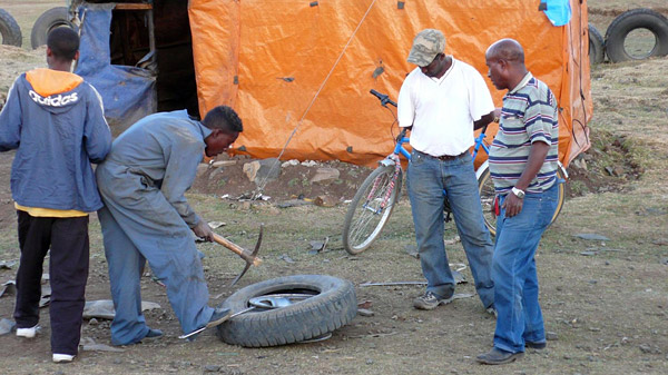
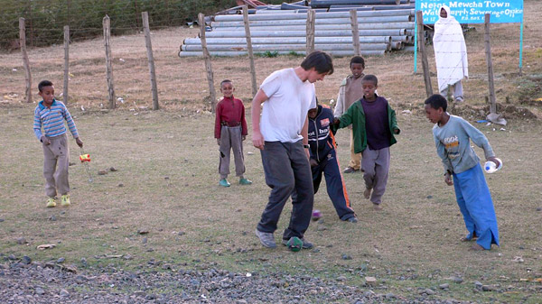
| Top left: It's not uncommon to see reminders of the decades of civil war along the roads and in the bordering fields. Here a dismembered tank still sits where it came to a stop. This region was the scene of intense battles that led to the eventual overthrow of the military dictator, Mengistu Haile Maryam. Top right: Another flat — what else is new? It's getting late in the day and we're not where we had hoped to be by this time. Bottom left: Around here, tire repair is done by hand — that's why they call a pick like this a "tire iron." Bottom right: Greg schools the local kids in soccer, while the tire on the Landcruiser gets replaced. | ||
January 25, 2008
We're back on the road before sunrise. We finally make it to Woldiya and stop at the Lal Hotel for a full breakfast and coffee. Everyone's mood changes for the better after we rinse off the road dust and clean up a little before we eat. But we still have about 230 kms to drive before we reach Mekelle, so after our meal and a quick walk to stretch our legs, we're back in the Landcruisers, determined to get to Mekelle. There we'll complete our administrative chores at the Culture and Tourism Bureau, resupply, spend the night, and head for the field once again.
 |
 |
 |
 |
|||
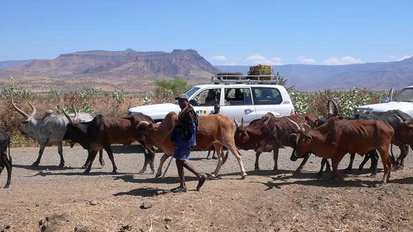
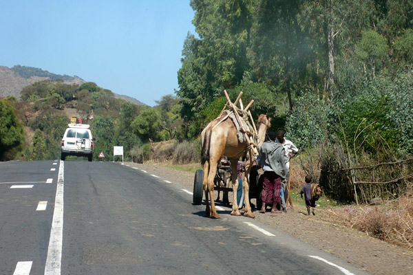
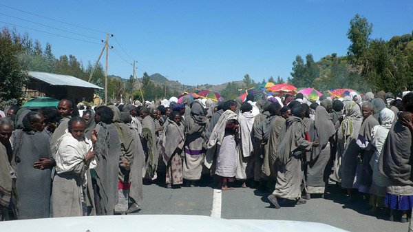
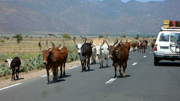
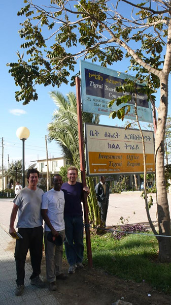
| Top left: The local landscape has changed once again: mountain passes and rugged terrain, interspersed by small towns and villages … and camels! Top right: Yet another obstacle in our path to Mekelle. We slow to a crawl as we approach a funeral procession for someone who must have been a very popular person in this small town. The crowd allows us to pass and be on our way. Bottom left: We pass by long-horned cattle as we continue north to Mekelle. Bottom right: We made it! Greg, Chalachew, and Randy outside the offices of the Culture and Tourism Bureau. | ||||||
We finally arrive in Mekelle in the late afternoon and before the local office of Culture and Tourism closes for the day. Chalachew introduces us to the commissioner and we obtain our letter of permission, a requirment for conducting field work in Tigrai. Mekelle is the capital city of Tigrai and the center for all these types of administrative activities. As a region, Tigrai is central to many important historical events in Ethiopia: the arrival of Christianity, brought by the Axumite Emperor in 400 A.D.; it was the final resting place (as legend contends) for the Ark of the Covenant, via Solomon and Jerusalem; and Emperor Menilek II defeated an Italian force at Adwa in 1896.
We check into the Axum Hotel, then drive into the commercial district to pick up food and a few supplies for the field. Hailay Gebreyesus, from the Institute of Paleo-environment, Human Evolution and Cultural Anthropology at Mekelle University, joins us for dinner at the Yordanis Restaurant in town. Hailay and Chalachew have previously done field work together. Hailay asks me to give a talk on our project, sponsored by his institute, at Mekelle University when we return from the field sometime next week. We set a date for next Wednesday afternoon at 4:00 pm.
Now, back to dinner: a variety of delicious and colorful vegetarian wats are served buffet style, many of which I haven't seen before. Pureed beans, lentils, spinach, vegetable stews, potatoes, carrots, salads — all piled onto injera. We sample the buffet and order zizzle (crispy with a wonderful spice) and special tibs (longer slices of lamb) as well. This is definitely one of the better restaurants we've been to so far, and most of the menu items are inexpensive, about 20 birr (just over two dollars).January 25, 2008
After breakfast in the hotel, we pack the Landcruisers with our gear and once again head out on the road. Hailay joins us to catch a ride to our first stop this morning, the small town of Hagere Selam. Hagere Selam sits on the top of the plateau and will be our last stop before we reach our next field site.
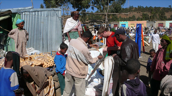
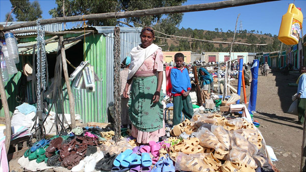
It's market day and we enter Hagere Selam via Main Street, along with many other shoppers and merchants. We need to purchase more grain sacks for collecting matrix in the field so Hailay brings us to a vendor. After some negotiation and examination of the goods, we settle on the bargain price of 3 birr a piece. Hailay tells me that this is the going price and no bargaining is necessary. We'll have to remember this next time we're in Addis, where we paid the inflated farinji price of 9 birr per bag in the Mercado. We said goodbye to Hailay but we'll see him again next week.
 |
 |
|
 |
 |
|
| Top left: Main Street, Hagere Selam, on market day. Top right: Hailay (in tan and white jacket), Chalachew, and Randy inspect recycled USAid grain sacks that we'll need for collecting sediment samples in the field. Bottom left: "Thanks ma'am, but I think we're good for shoes." Bottom right: Small family-run stores sell everything from hardware to clothes, like this dress shop on Main Street. | ||
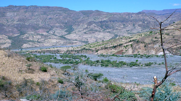
Back in the Landcruisers and on the gravel again. From Hagere Selam, we start a gradual descent and eventually reach the edge of the plateau where, from a breathtaking overlook, we can see the vast exposures of Late Triassic and possibly Early Jurassic red beds of the Adigrat Sandstone Formation.
 |
 |
|
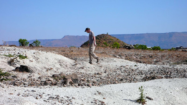
| Left: We stop at the edge of the plateau before heading topographically and stratigraphically down section to the Late Triassic sediments below. I take a group shot of Teshome, Greg, Randy, Chalachew, and Abdi standing on the brink. Right: Down in the valley, the base of the Adigrat Formation is well exposed in some areas, just below the steep cliff-forming member seen in the background. | ||
The Adigrat Sandstone, or Adigrat Formation, is a 300- to 600-meter-thick, medium-grained, non-calcareous quartz sandstone that is yellowish to red and pink in color. It represents a shallow transgressive stage of the Mesozoic sea over this region of Africa during the Late Triassic–Early Jurassic, beginning more than 200 million years ago. Sedimentological studies reveal a shallow water, sandy facies with the majority of the sediments deposited in a littoral environment. Fluviatile and deltaic sediments are present in the lower part of the formation.
My previous visits to this area in 1997 and 2004 resulted in the discovery of the first vertebrate fossil localities in Unit I, the lowest part of the formation. The unit weathers into low-lying badlands at the base of the higher cliff-forming member in this region of Tigrai. I was fortunate to find a new species of fossil temnospondyl amphibian, described in 1998, that we named Abiadisaurus witteni. The genus is named for the nearby town of Abi Adi; the species is named in honor of Dr. Karen Witten, a physician studying the prevention of malaria at a local clinic in Mekelle — she was a very good friend of our crew's in 1996.
One of the main goals for this portion of the trip, besides introducing Randy and Greg to the Late Triassic of the region, is to review and relocate some of my previous localities, georeference those sites, and resample and prospect for new fossil-bearing horizons here.
 |
 |
 |
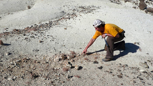
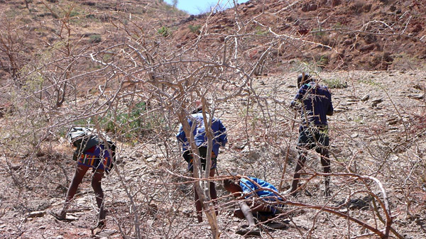
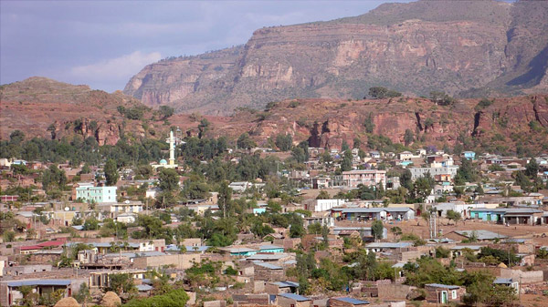
| Left: Welcome to Abi Adi. During our travels, we've noticed that there are often multiple ways of spelling a place name. The locals here apparently prefer a double "b" and "d" as in this sign. Center: The town of Abi Adi lies at the base of the cliff-forming Adigrat Sandstone. The geology is very similar to areas of "red beds" exposed in the southwestern United States, particularly Arizona and New Mexico. Right: Randy and Mark begin their hunt for fossils in the Adigrat Formation. | ||
We're anxious to get out in the field tomorrow to explore and prospect. I'll be sharing more with you in my next installment as we prospect these "red beds" and local exposures of the Adigrat Sandstone, so stay tuned!
All photos by Mark Goodwin, Randy Irmis, and Greg Wilson.