Features of San Francisco Bay: From River Valley to Estuary , Figure 1
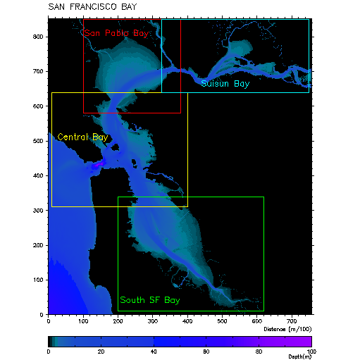
Map showing shape of San Francisco Bay and water depths along its length (see scale at bottom).
Source: Image is from the San Francisco Physical Oceanographic Real-Time System (SFPORTS) web site, operated by the U.S. Geological Survey and the National Oceanographic and Atmospheric Administration (NOAA).
Back
updated April 3, 2002
UCMP Home | What's new | About UCMP | History of Life | Collections | Subway
![]()