![]()

![]()
![]()
![]()

![]()
Trip Log: Tuesday, July 16, 2002
July 16, 2002 was the day we began our trip to Deadhorse (Prudoe Bay), where the flight to the Colville River will depart.
Our day began under a bright blue sky with scattered clouds—a warm morning at 66 degrees.
 By
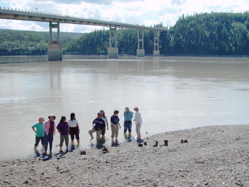
3:00 p.m., we had reached the river where the mysterious ceremony
Roland had promised to the Yukon River first-timers awaited. The feared
ceremony turned out to be not so bad: standing barefoot in the river for
five minutes (left). Since the water was a relatively mild 68 degrees
everyone survived quite happily.
By
3:00 p.m., we had reached the river where the mysterious ceremony
Roland had promised to the Yukon River first-timers awaited. The feared
ceremony turned out to be not so bad: standing barefoot in the river for
five minutes (left). Since the water was a relatively mild 68 degrees
everyone survived quite happily.
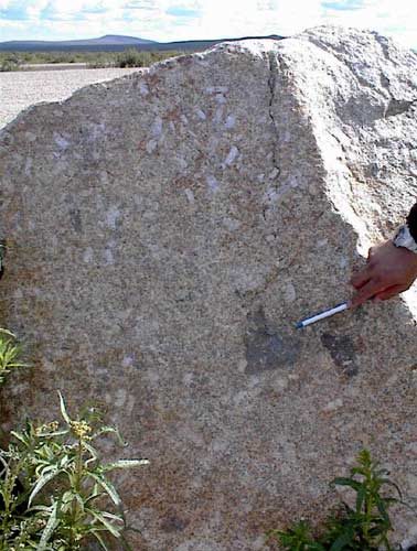
At 4:30 p.m. we reached Finger Rock. This odd rock actually does look like a large finger pointing back at Fairbanks. It is part of a plutonic inclusion: a large chunk of magma that cooled slowly under the surface. This hard rock resists weathering, and so stands out upon the surface. As we drove on, we entered the ecozone between the taiga (pine forest) and the tundra.
|
|
|
|
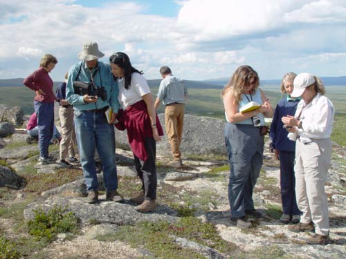

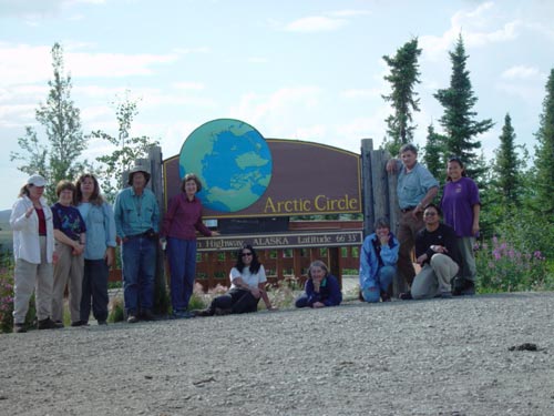 At
5:00 p.m. we were literally driving around the Arctic Circle
as Roland carefully drove us around the sign marking the Arctic Circle
(right). This was a great “photo op” but gazillions of black flies encouraged
a short stay.
At
5:00 p.m. we were literally driving around the Arctic Circle
as Roland carefully drove us around the sign marking the Arctic Circle
(right). This was a great “photo op” but gazillions of black flies encouraged
a short stay.
By 7:30 p.m. we had driven through the Brooks Range with its sweeping slopes, reached Coldfoot and set up camp at Marion Creek campground a few miles past Coldfoot.
 After
a great Chicken Caesar Salad dinner prepared by Phil and Pam, we settled
in for a night of slapping flies and mosquitoes.
After
a great Chicken Caesar Salad dinner prepared by Phil and Pam, we settled
in for a night of slapping flies and mosquitoes.
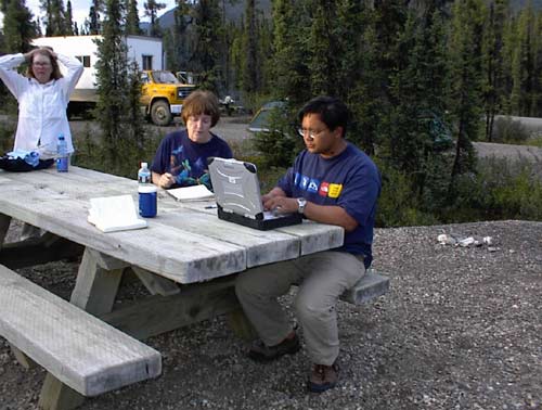
Reporters for the day: Peg and Chris (at right, typing up this report!)
Back (July 15) | Forward (July 17)