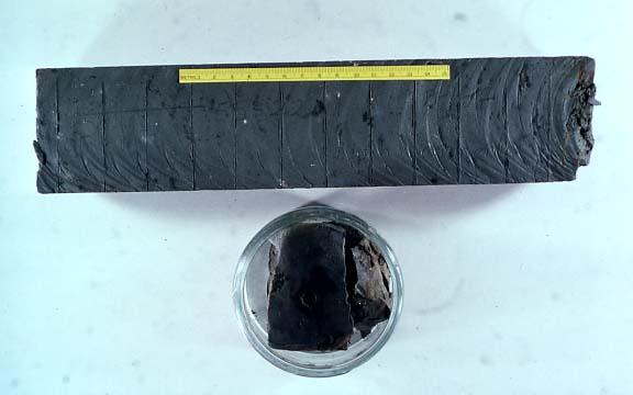
Slide: Core of Bay mud and sample used for studying the sediments
The cores not only provide engineers with information; these same cores can reveal the secrets of the Bay's history. By looking at the microorganisms that lived in this mud and the waters above it, we can learn a lot about what the Bay was like in the past.
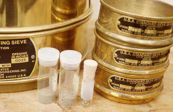
Slide: Sieves
We take a small amount of core and wash away all the fine muds through sieves like these, leaving only the sand-size grains, which we study to determine the physical and biological characteristics of the muds.

Slide: Microorganisms in Holocene mud
This slide by Brian Atwater shows some of the foraminifera, diatoms and seeds found in Bay mud. The skeletons of microorganisms that lived in the water tell us about the environmental conditions in the Bay at the time they were alive.
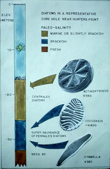
Slide: Environments of microorganisms
Each organism lives in a particular part of the estuary under certain conditions of water depth and temperature or amount of exposure to air. We can use this to reconstruct conditions in the Bay, as shown in this slide by Brian Atwater.
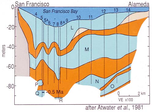
Slide: Cross section of sediments beneath San Francisco Bay
As sea level changes, the valley is alternately bay or dry land. This has been happening for at least the past half million years. By looking at the different kinds of material in many cores, we can tell that sea level has been high enough to have filled the valley at least four and perhaps seven times in the past half million years. We can also see that during glacial times, the valley was dry and deposits were left by rivers flowing through the dry valley.
- Dark blue is the present water
- Light blue are estuarine (bay) sediments; L is the mud accumulating today; M-R are past estuaries
- Orange is alluvium (deposited by streams)
- Tan is aeolian (wind-blown) sand
Borehole 12 penetrates four estuarine units (L-0). It is not clear whether P-R are the same estuaries or others. An ash layer near the base of borehole 5 has been dated at 450,000 years (adjusted from the 0.5 million years shown).

Slide: Extent of the last interglacial deposits in the South Bay
During the last interglacial, 120,000 years ago, sea level was about 6 meters (20 ft) higher than today, and the bay was a good deal bigger and probably deeper and somewhat colder. The dashed line indicates approximately where deposits of the last interglacial have been found in South Bay boreholes.

Slide: A rising mean tide
Sea level is still slowly rising, at a rate of about 2mm/year.Much of this rise is due to the thermal expansion of oceans - they are still warming from the last Ice Age. Global warming will exacerbate this rise. What does this sea level rise mean for the future of San Francisco Bay margins?