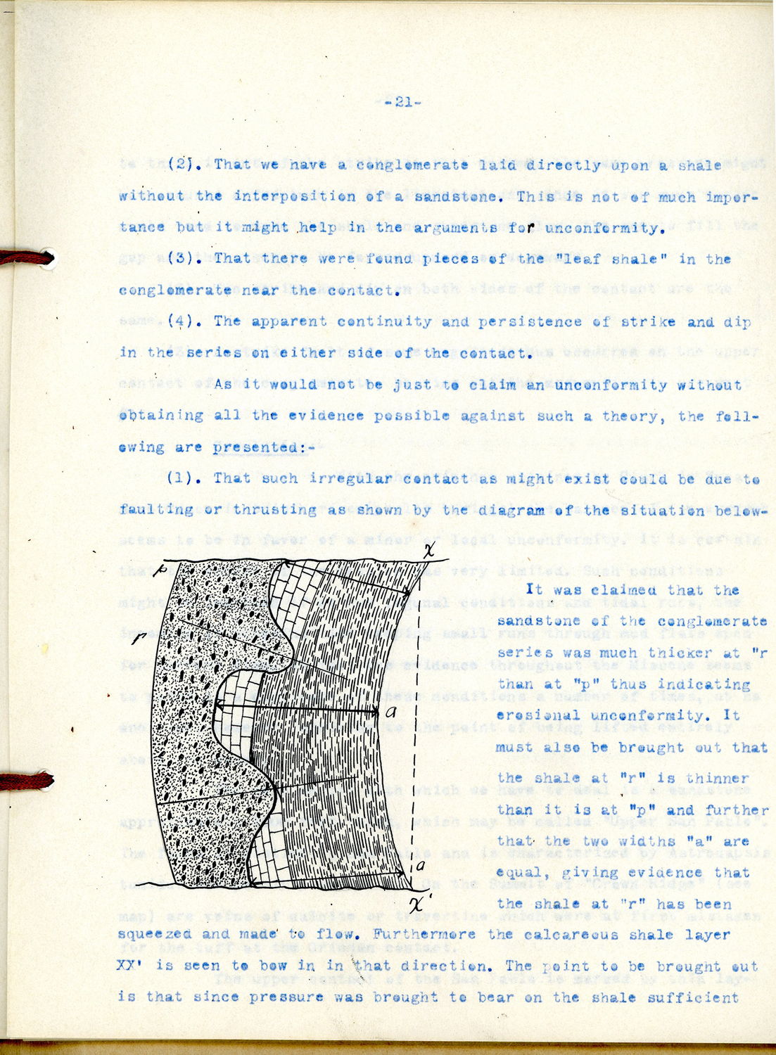
 Looking at UCMP’s modern offices and collections space, one might not appreciate that the paleontology tradition at Berkeley stretches back more than one hundred years. But now the CLIR/UCMP Archive Project is bringing this history to light. Some of the oldest supplemental locality files I have come across this semester contain class reports and geologic maps prepared by a Cal field geology class in the summer of 1911. Led by Bruce L. Clark, who eventually became the first director of the UCMP, the class camped on the south slope of Mount Diablo in and around what is today Mount Diablo State Park. The scientific goal of the one-month course was to reconstruct the tectonic history of the area through mapping of exposed rock units and collecting of marine invertebrate fossils that are indicative of geologic ages and past environments.
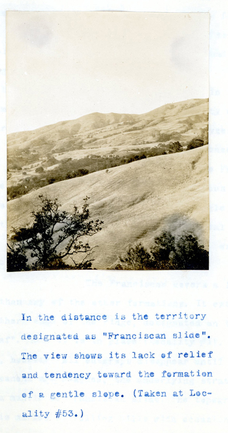
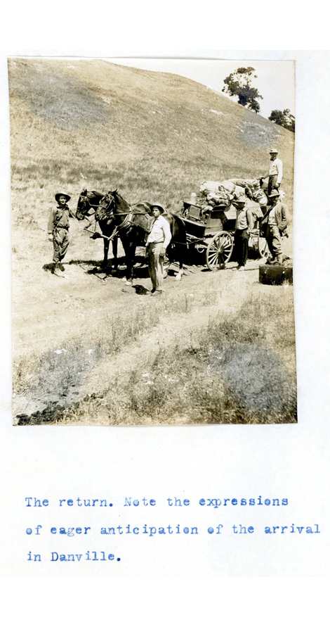
Here are some of the photographs from student Irving V. Augur’s report along with the original typewritten captions:
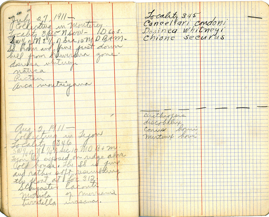
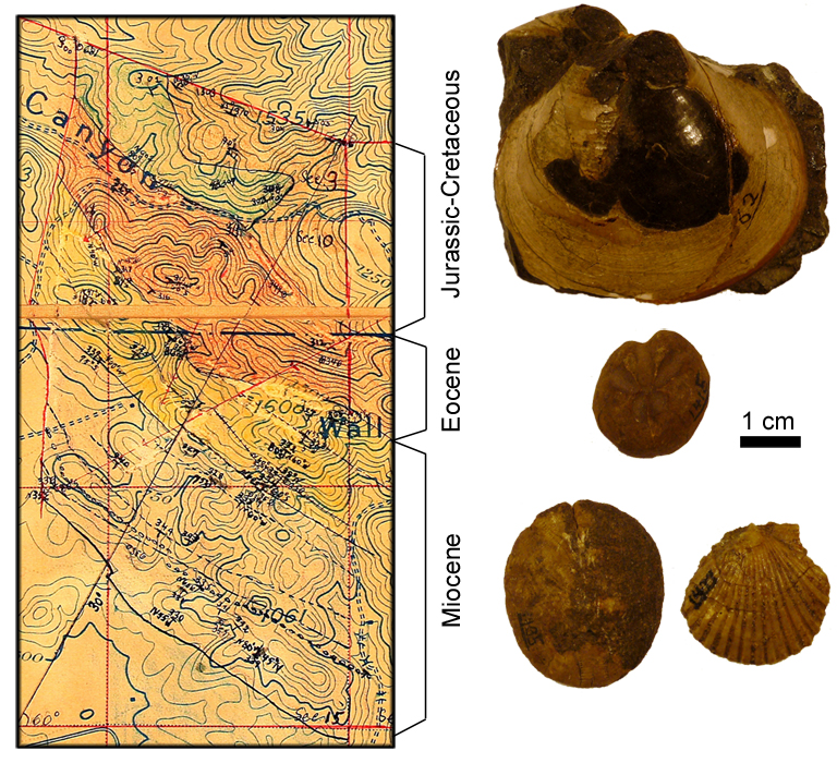
Also in the archive are students’ field notes and maps, such as the ones below by William S. W. Kew. In his notes, he recorded the orientation of rock layers (e.g., strike of N60°W and dip of 60°S for Locality 27) and scientific names of fossil invertebrates that had been collected at various locations on the mountain (e.g., Dosinia whitneyi is a clam).
[Fossils from Mount Diablo: top, a Cretaceous clam, specimen number 199004; middle, an internal mold of an Eocene heart urchin, Schizaster lecontei, specimen number 199000; bottom left, Miocene sand dollar, Astrodapsis sp., specimen number 199001; bottom right, a Miocene scallop, specimen number 199002.]
And yes, the fossil clam, sand dollars and scallop pictured above are the specimens collected by the students of the field course 100 years ago. Some of the fossils brought back are currently stored in the Campanile on the Berkeley campus, while others have found their home in the UCMP’s research collections in the Valley Life Sciences Building.
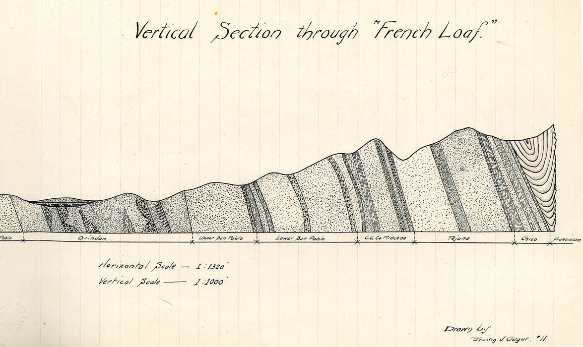
After a month of surveying, the students examined these data to figure out the ages of rock layers as well as the arrangement of rocks beneath the surface of the mountain. Here is an exquisitely drawn diagram by Auger.
So what makes Mount Diablo geologically interesting? If you look closely at Kew’s map with color-coded rock formations, you will notice that, as one climbs up the mountain, the underlying rock layer becomes progressively older from the Miocene (faint purple and yellow) to Eocene (red), Cretaceous, and Jurassic (green and orange)—which is a bit counterintuitive, isn’t it? Furthermore, Auger’s inferred cross-section through the mountain suggests that the strata are almost vertically oriented.
In his class report, I. V. Augur wrote:
“The general structure of Mt. Diablo region was for some time a point of disagreement, the reason being that while on the north side evidence of the strata dipping away from the mountain suggested an anticline, evidence on the opposite side did not bear out the assumption, since the general dip was in the same direction and the succession of beds reversed. Prof. J. C. Merriam, however, after a careful study of the structure and faunal relations, pronounced it an overturned anticline, which structure has been generally accepted by geologists who have examined the territory under discussion” (Augur 1911, p. 2).
After a century of additional research, the interpretation of the mountain’s geology has changed. Experts today think that Mount Diablo is largely a product of a series of thrust faults (follow this link to see a simplified animation). Specifically, the Jurassic-Cretaceous rocks (which now form the upper portion of the mountain) have been uplifted along the fault zone in the last few million years, bending the more recent Eocene to Miocene rock layers on the southwest side of this zone (the lower portion of the mountain that was mapped by Kew and his classmates).
So the old class reports are uniquely valuable for giving us glimpses into the development of scientific ideas through the eyes of students. The detailed observations recorded in the class reports reveal that the field camp was really a group research project involving students.
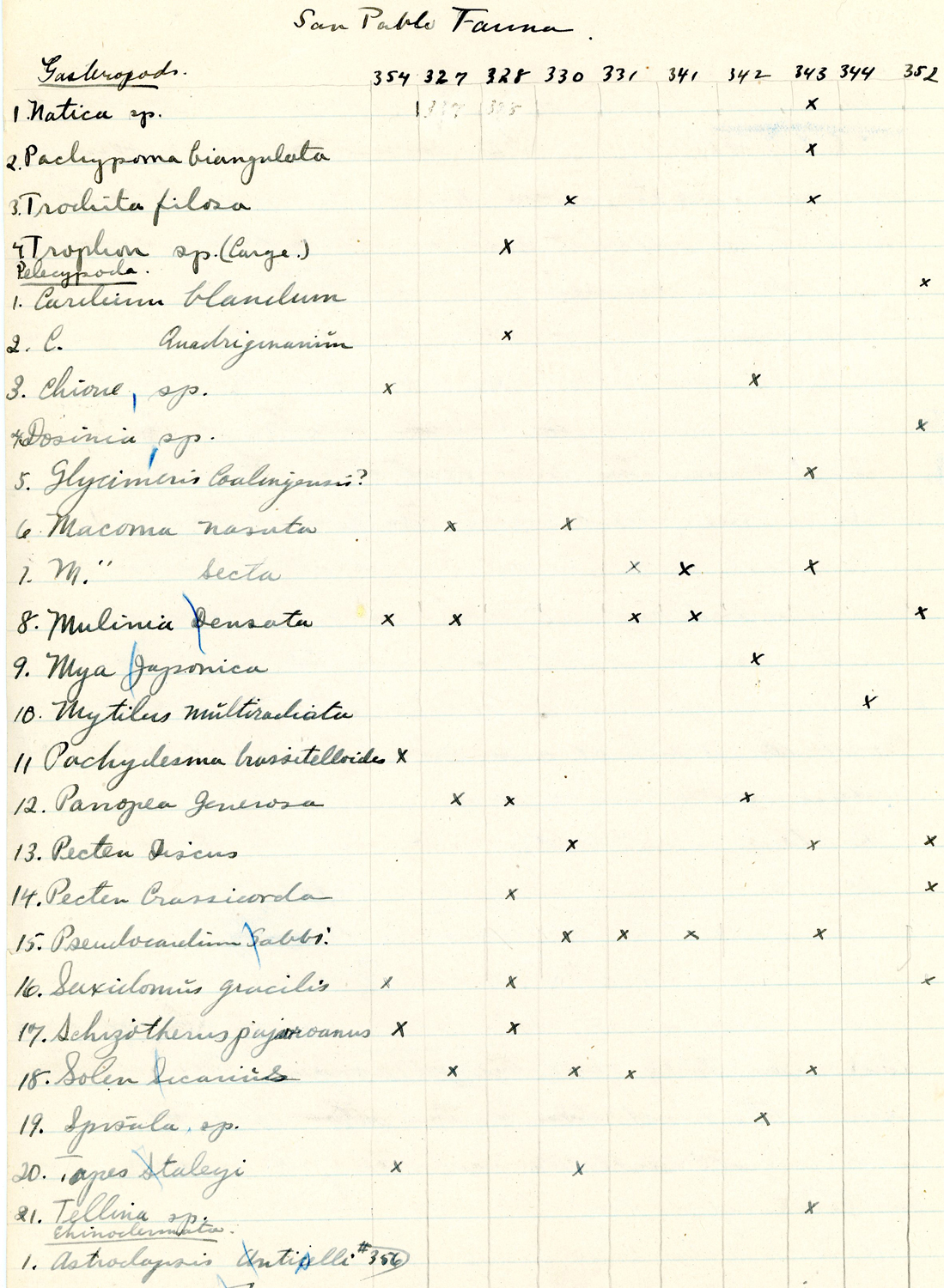
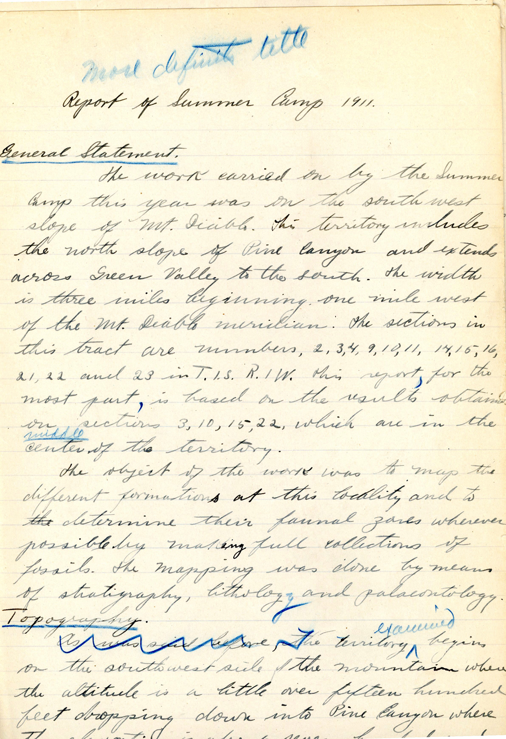
As one flips through these reports, it is worth keeping in mind that, in 1911, the theory of continental drift was still being formulated by Alfred Wegener. More locally, this is back when John C. Merriam and colleagues from Berkeley had been tirelessly digging up asphalt-covered fossils from the tar pits of Rancho La Brea in Los Angeles, and an undergraduate student by the name of Charles L. Camp was busy catching reptiles and amphibians (such as this arboreal salamander) for the newly-founded Museum of Vertebrate Zoology.
After 1911, Clark continued to teach and conduct research in the Mount Diablo area for many more years. This not only contributed to greater understanding of regional geology but also led to a fortuitous discovery in 1927 of one of the most significant Miocene mammal localities in California, the Black Hawk Ranch Quarry. Also notably, some of the students from the field camp went on to become respected geologists—Kew, for instance, pursued his doctoral degree in the Department of Paleontology and produced important works on fossil echinoderms (sea urchins, sand dollars, and their relatives).
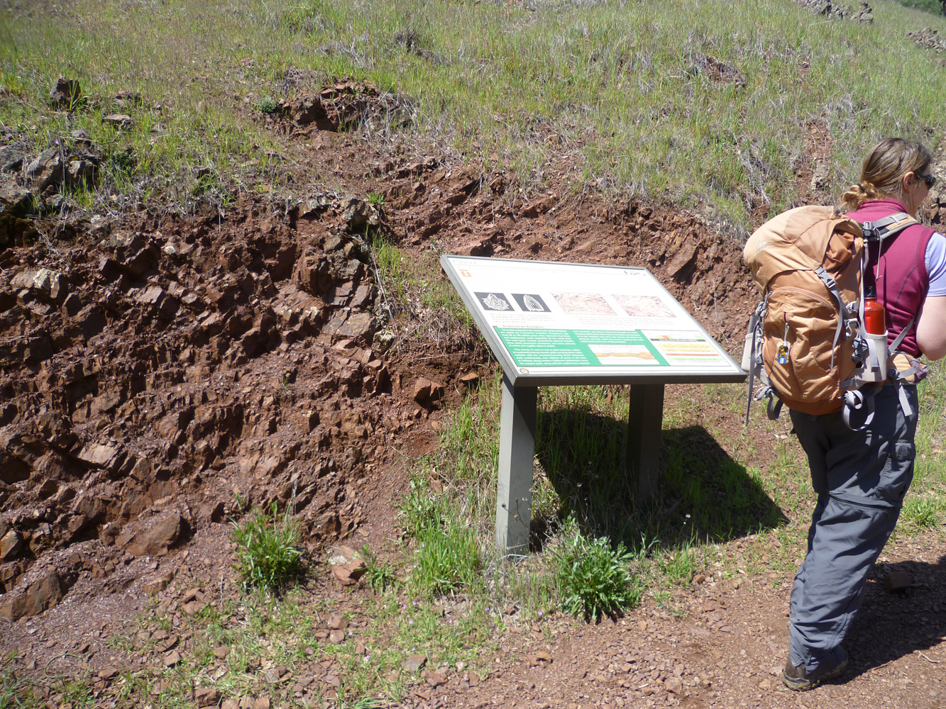
To learn more about the geology of Mount Diablo, check out Doris Sloan’s Geology of the San Francisco Bay Region (University of California Press) and take a hike on the interpretive Trail Through Time on a sunny day. I end with a few images from my recent excursion to the mountain with my colleagues. Considering the extent of Clark’s and his students’ survey effort, we may have crossed their footsteps at some point as we climbed Eocene marine sandstones (below left), traversed meadows dotted with California Poppies (below center), and stood by outcrops of ancient radiolarian chert (below right).
Special thanks to Dave Strauss for photographing Kew’s map, David K. Smith for information on the geologic history of Mount Diablo, and Renske Kirchholtes and Emily Lindsey for the trip to Mount Diablo State Park!
More stories from the CLIR/UCMP Archive Project
