Assistant Professor Seth Finnegan led an instructive and enjoyable field trip to the Kettleman Hills and Death Valley over Spring Break in 2014 and grad students and staff spent the rest of the year eagerly awaiting news about the next one.
Seth, in consultation with Assistant Professor and paleobotanist Cindy Looy, announced that the 2015 field trip would be to more localities in southern California. Seth's objective in offering these field trips has been to "give UCMP graduate students … experience in looking at fossils in the field," with an emphasis "on stratigraphy and interpretation of the depositional environment, taphonomy, ichnology and paleoecology."
By adding more structure to the 2015 field trip, the trip itself was the focus of a spring semester seminar in which grad students could enroll. In weekly meetings leading up to the trip, pairs of grad students researched the formations and regions that the group would visit and gave short presentations on those areas.
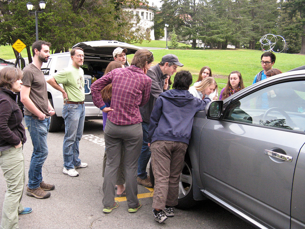
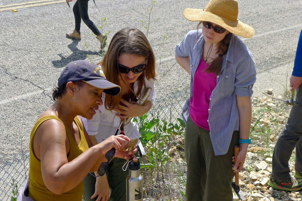
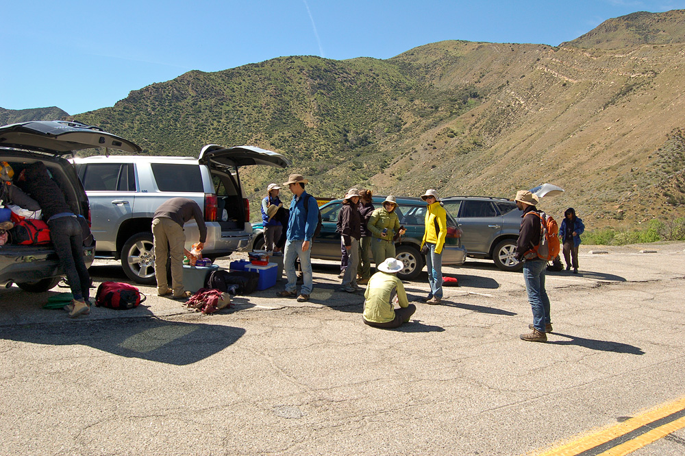
In early March, the itinerary was finalized, arrangements for lodging had been made, three SUVs had been rented, and the necessary supplies were obtained. On Saturday, March 21, 15 people rendezvoused at the West Circle on campus. After filling all water jugs and stowing the gear, the group — in two private vehicles and the SUVs — left campus around 9:00 AM and headed south. Assistant Director for Education and Public Outreach Lisa White was in her car with Museum Scientist Erica Clites; grad student Rosemary Romero rode with fellow student Renske Kirchholtes. Seth and grad students Dori Contreras, Zixiang Zhang, and Emily Orzechowski were in the white SUV; in the black one were grad students Ash Poust, Caitlin Boas, and Jeff Benca; and Cindy was in the silver SUV with graphic designer Dave Smith, and grad students Camilla Souto and Natalia Villavicencio. Like the previous year, each vehicle was equipped with a walkie talkie, courtesy of Lisa, which again proved invaluable.
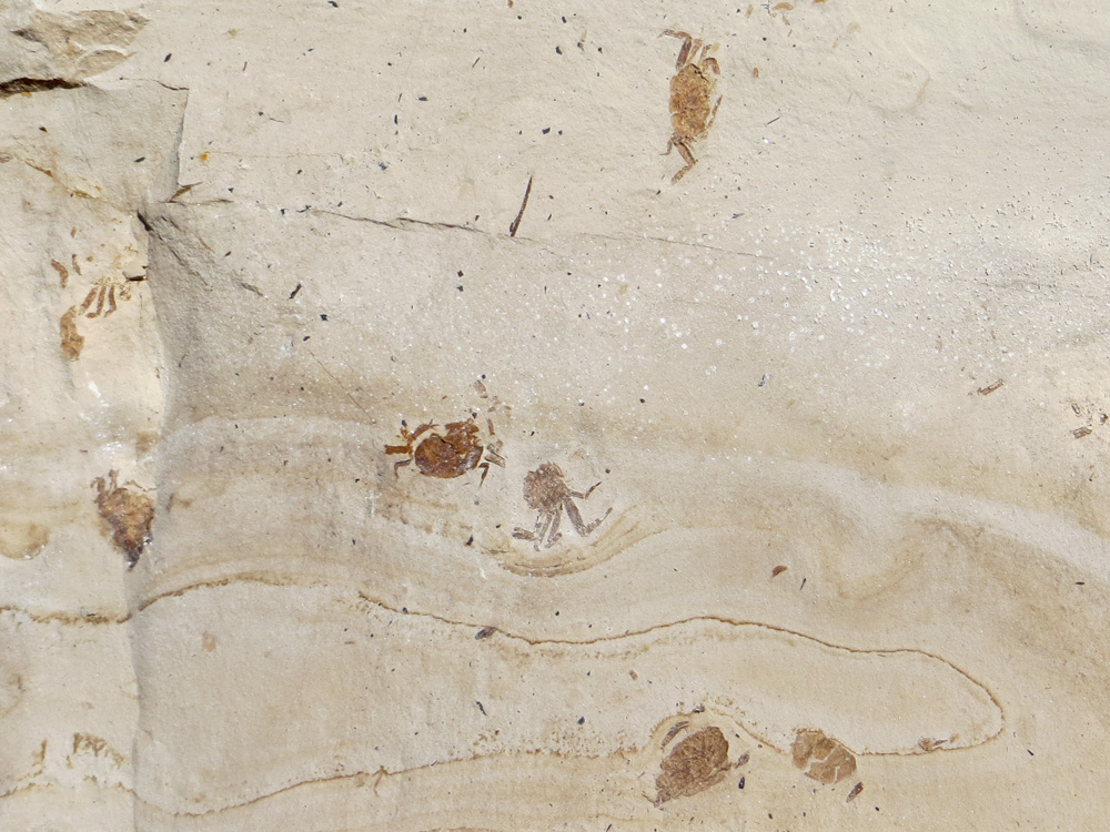
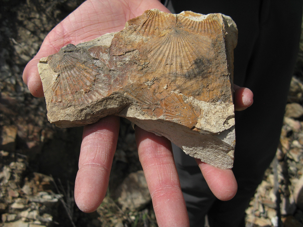
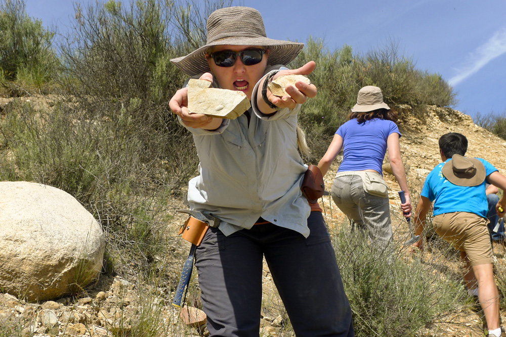
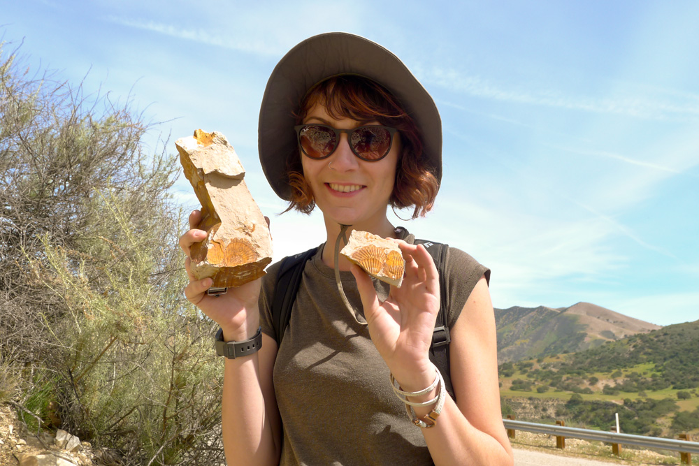
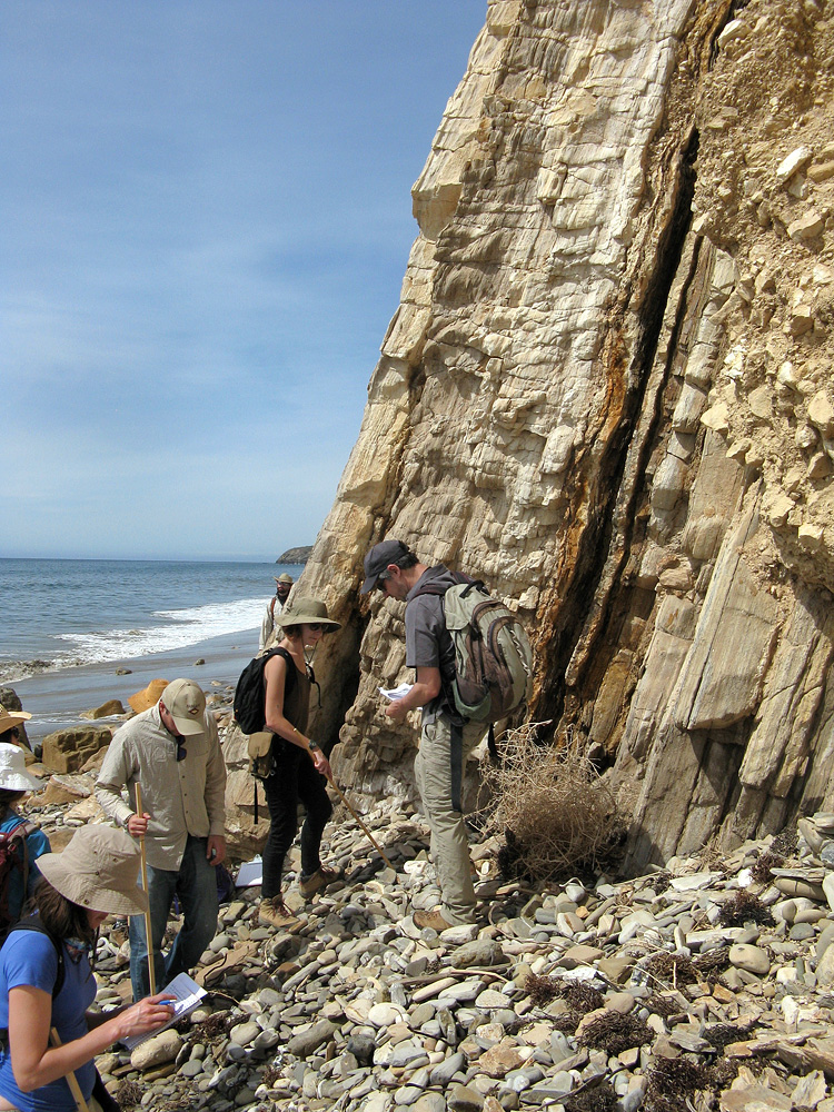
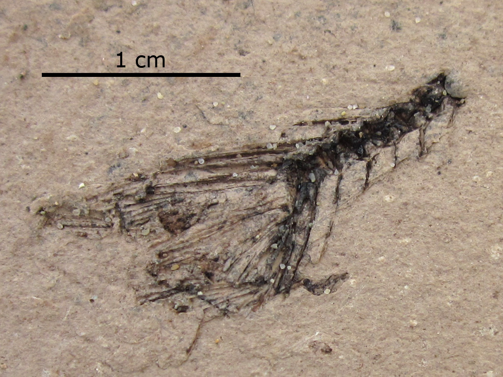
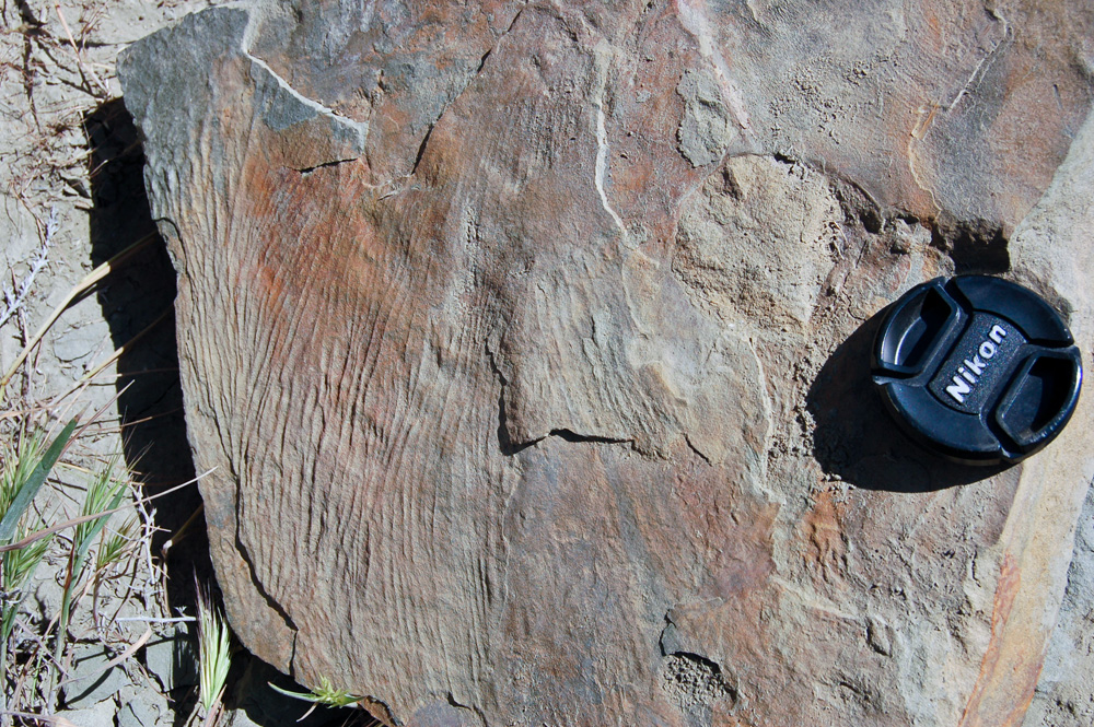
The group arrived at its first locality on Arroyo Seco Road, just south of Soledad in Monterey County, right around noon. The cars parked on the shoulder at a point where the road cut through a southeasterly dipping sequence of siliceous, diatom-rich mudstones of the extensive Monterey Formation. Lisa had taken many a student group to this locality in the past and predicted that we'd find small pea crab fossils. Dori was the first to approach the exposure and she picked one (a crab fossil) up within a matter of seconds. This discovery was followed by many more, as the fossil crabs — each being about an inch across — were quite abundant. Lisa explained that these deposits had formed in a deep marine basin (the Salinas Basin) during the middle to late Miocene.
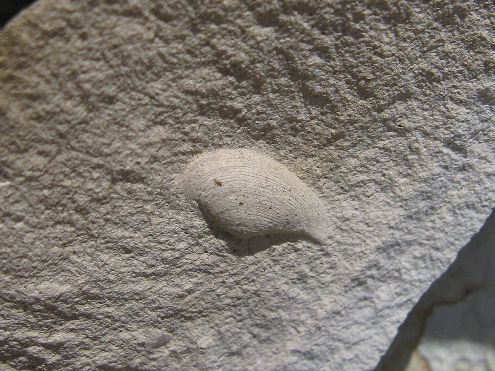
After a roadside lunch of sandwiches, the group moved about a mile farther down the road where a different assemblage of fossils were found. Here, in an older sequence of the Monterey Formation, a number of bivalves, gastropods, and brachiopods (an unusual find in Miocene rocks) were identified. The time spent at this locality was cut short when a nearby resident complained about where we'd parked our vehicles. So the caravan went into the town of Greenfield to gas up before continuing south on Route 101 for another three hours.
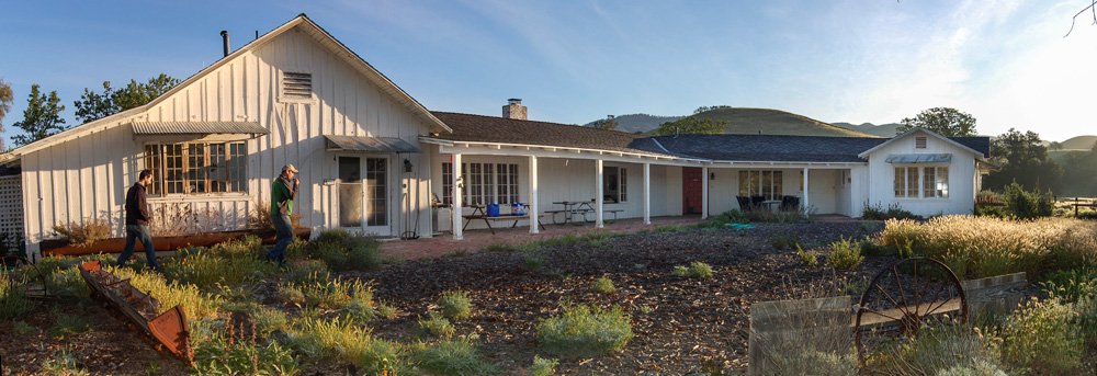
At Los Olivos, the group exited and made its way to the Sedgwick Reserve, a real gem in the UC Natural Reserve System. The group stayed in the reserve's sprawling Ranch House, surrounded by mixed oak woodland and grassy fields. There were plenty of sleeping spots for everyone, both indoors and out (some chose to pitch their tents). Lisa and Erica were the principal chefs this first night, preparing an amazing dinner of burritos.
Sunday, March 22
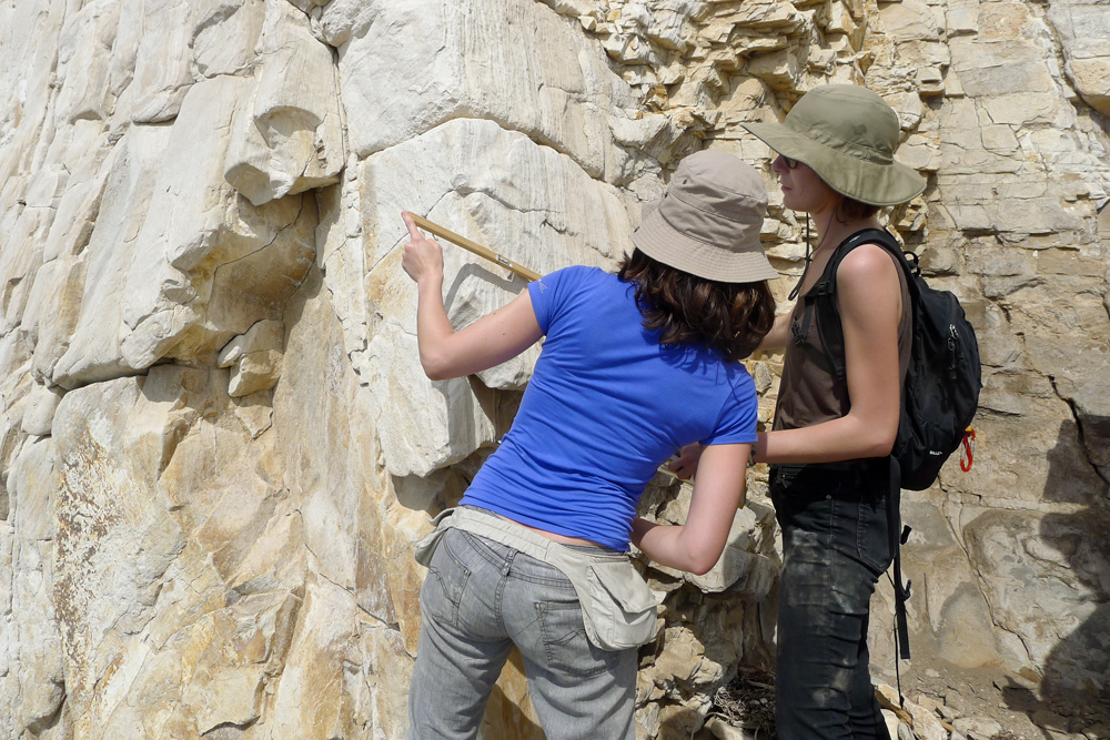
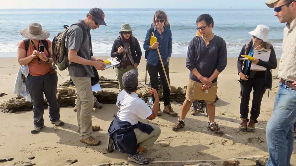
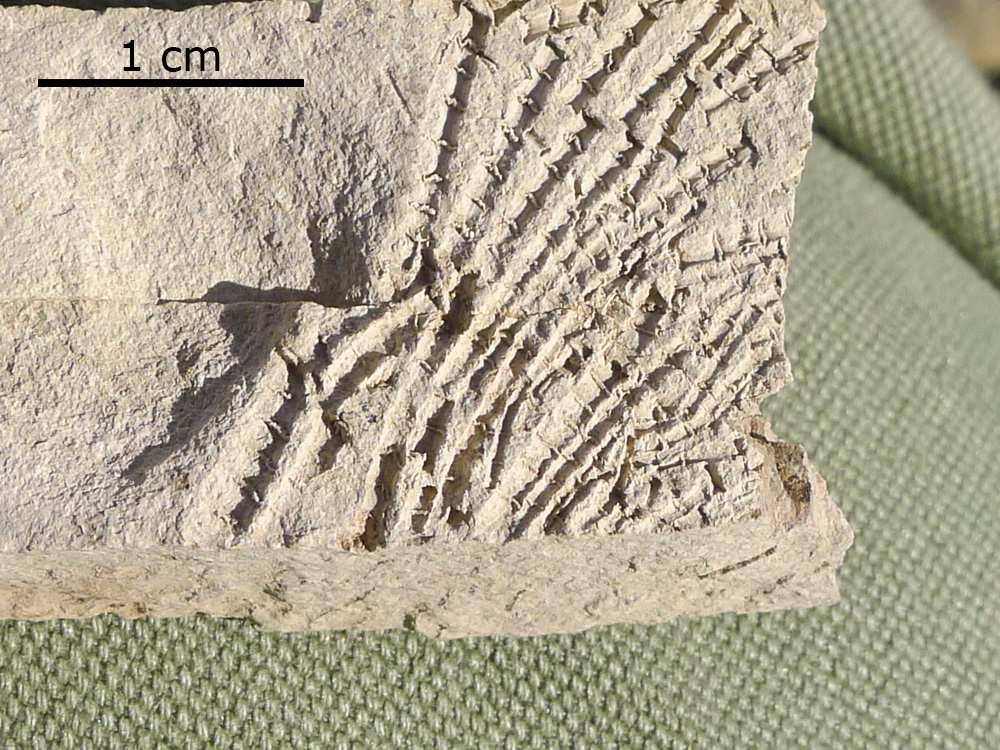
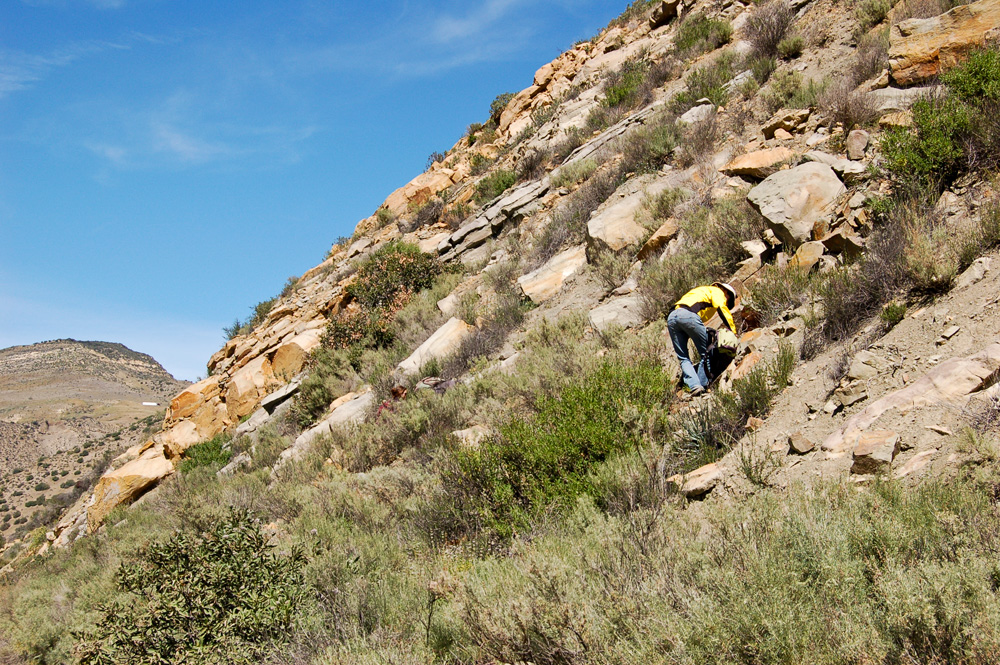
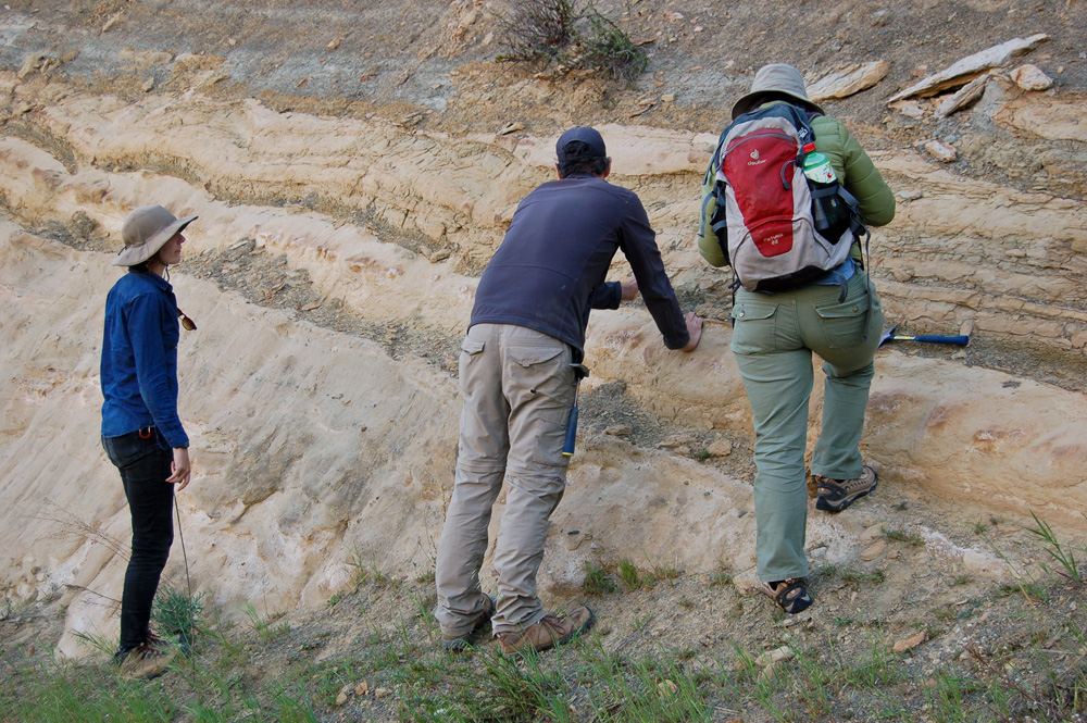
With everyone squeezing into four vehicles (Renske's car was left at the reserve), the group drove to Solvang to pick up grad student Lucy Chang, who had taken an overnight bus down from the Bay Area. After grabbing some coffee and pastries at Olsen's Bakery, everyone (we now numbered 16) drove on to Gaviota State Park, 33 miles west of Santa Barbara. With clipboards and makeshift Jacob staffs in hand, Seth took us out to the beach, where we walked east along the coastal cliffs. These were spectacular, south-dipping layers of more of the the Monterey Formation's siliceous facies. We were reminded that the Monterey Formation is the principal source of oil in California, a fact brought home by the presence of offshore drilling platforms. Although Miocene in age like the Salinas Basin rocks to the north, the Monterey rocks here accumulated in another basin, the Santa Barbara Basin, and at deeper depths. Seth and Cindy divided the students into groups of two and had them try their hands at measuring some sections using the Jacob staffs, with an emphasis on interpreting the origins of the layers they were examining.
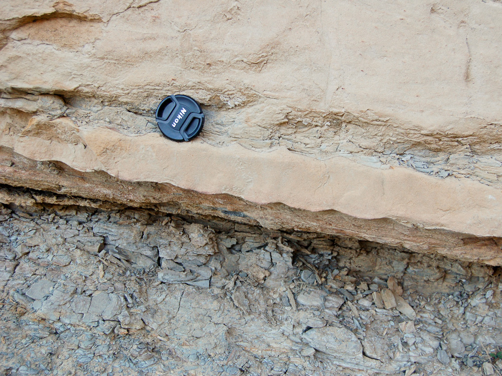
After a quick lunch back at the vehicles, we returned to the beach and headed to the west side of the Gaviota pier. Here, Seth brought us to an exposure quite different from what we had seen earlier in the day. A dark mass of variable texture seemed to cut across the typical buff-colored rocks of the Monterey Formation. It was explained that we were looking at a marine channel fill. This and two other such fills farther along the beach were described in a 2007 paper by Surpless et al.1
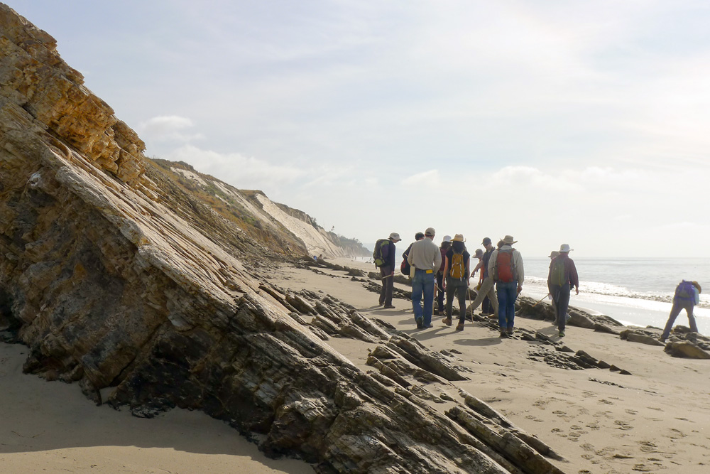

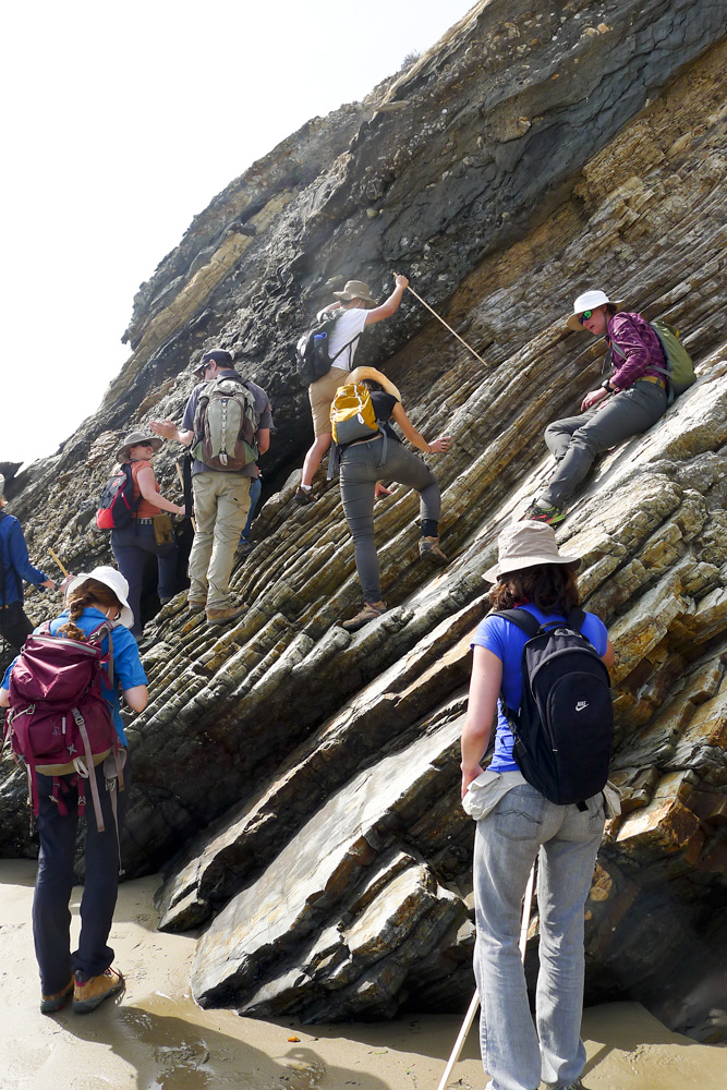
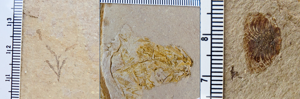
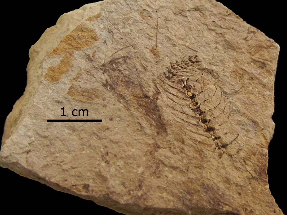
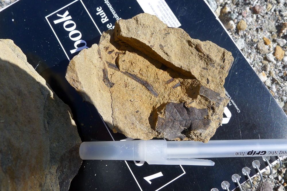
From Gaviota, we attempted to gain access to the classic Naples Beach locality a couple miles west of Goleta, but it appeared to be private property, so we went to Plan B and drove to El Capitan State Beach, a few miles back along 101. Again, we encountered excellent coastal exposures of the siliceous Monterey Formation. We had seen some macrofossils at Gaviota, but they appeared to be more common at El Capitan. A few minutes of searching turned up fossils of algae, fish, and a few unidentifiable organisms.
We returned to the vehicles around 5:00 and drove back to the Sedgwick Reserve. Dori and Jeff collaborated on dinner preparation.
Monday, March 23
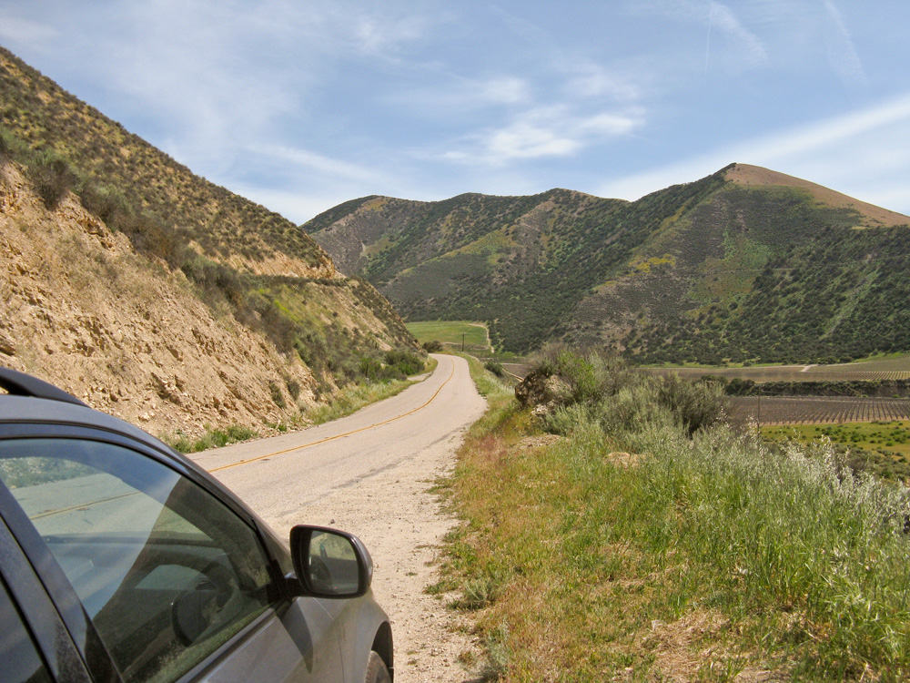
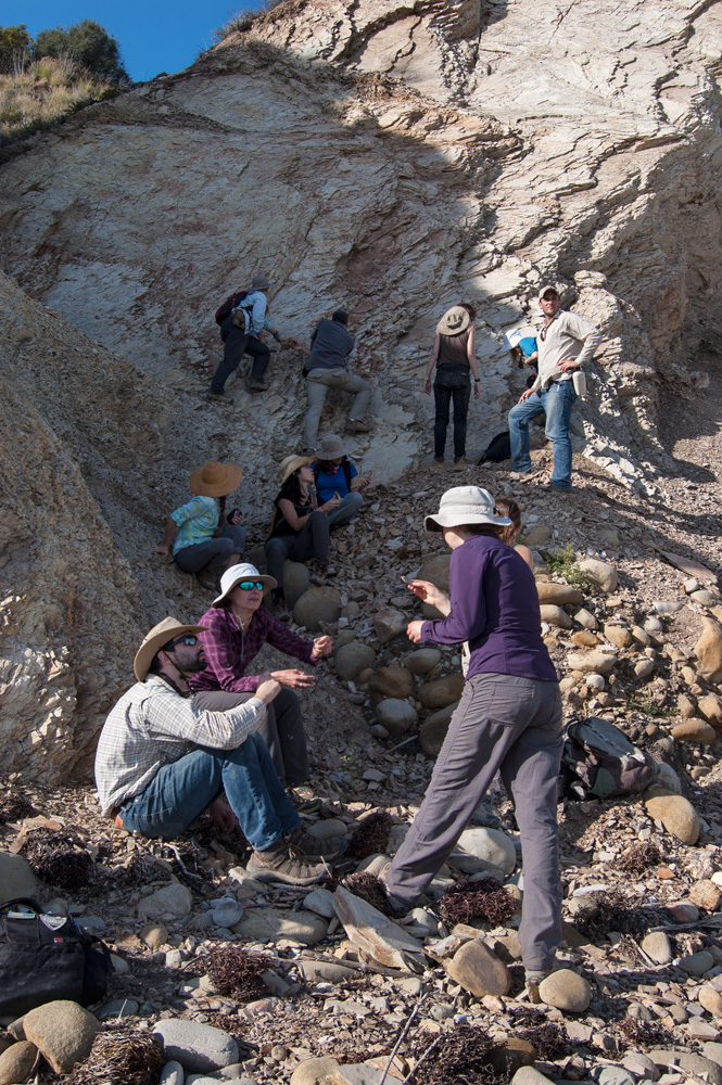
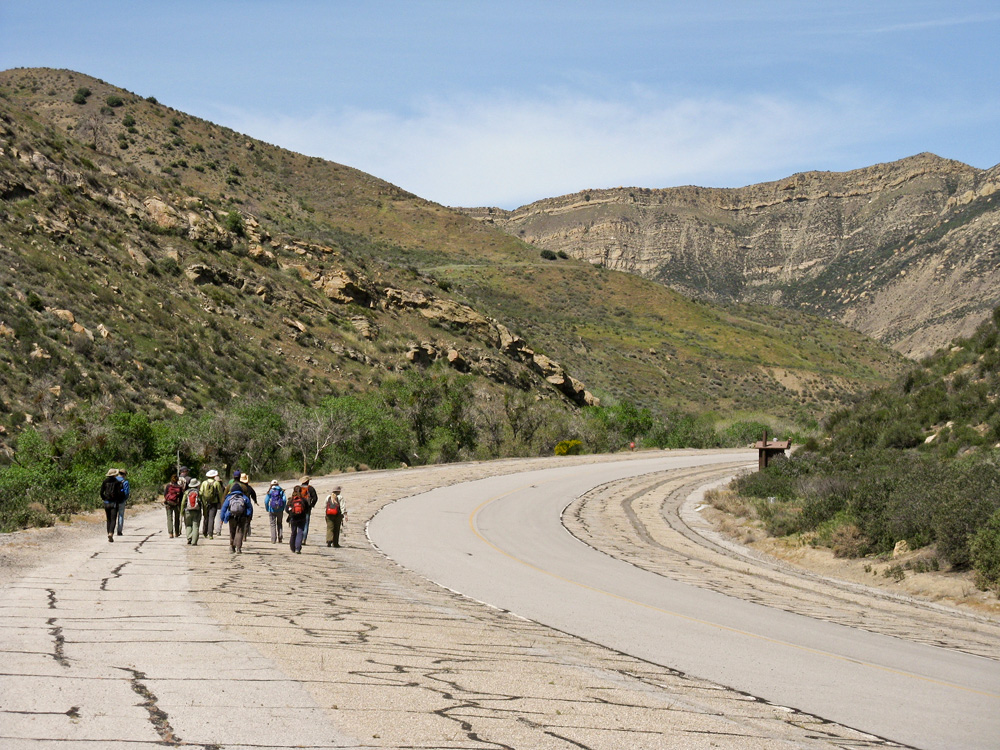
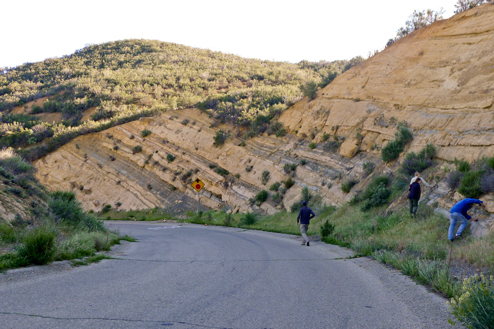
People started moving around 7:00 AM, and after a simple breakfast and cleaning of the Ranch House, we were on the road by 8:30 or so. We drove north up 101, gassed up in Santa Maria, turned east on State Route 166 — a very scenic route — and hit Interstate 5 north of the Grapevine. We then turned south and exited a few miles south of Pyramid Lake on Golden State Highway2. We followed the road north as far as we could but barriers blocked the way a couple miles from Pyramid Lake Dam. We were now in Piru Gorge, near the western side of Ridge Basin, an elongate Miocene basin that filled with about 14,000 meters of sediment during a seven-million-year period. The basin formed by the stretching and sinking of crust along a bend in the San Gabriel Fault. The basin's sediments show a transition from marine to lake and river sources.
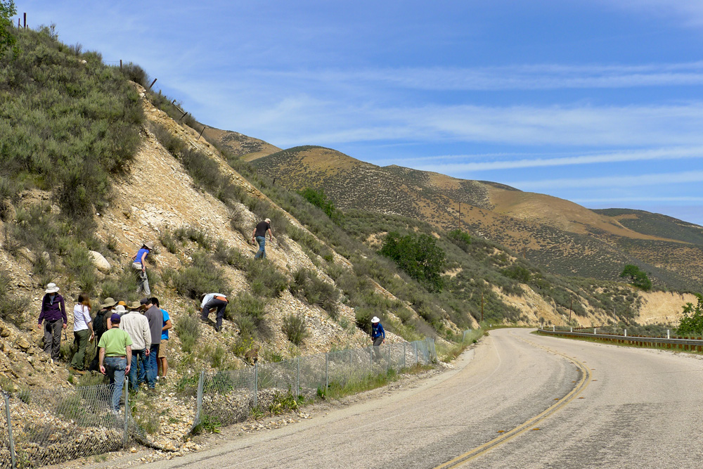
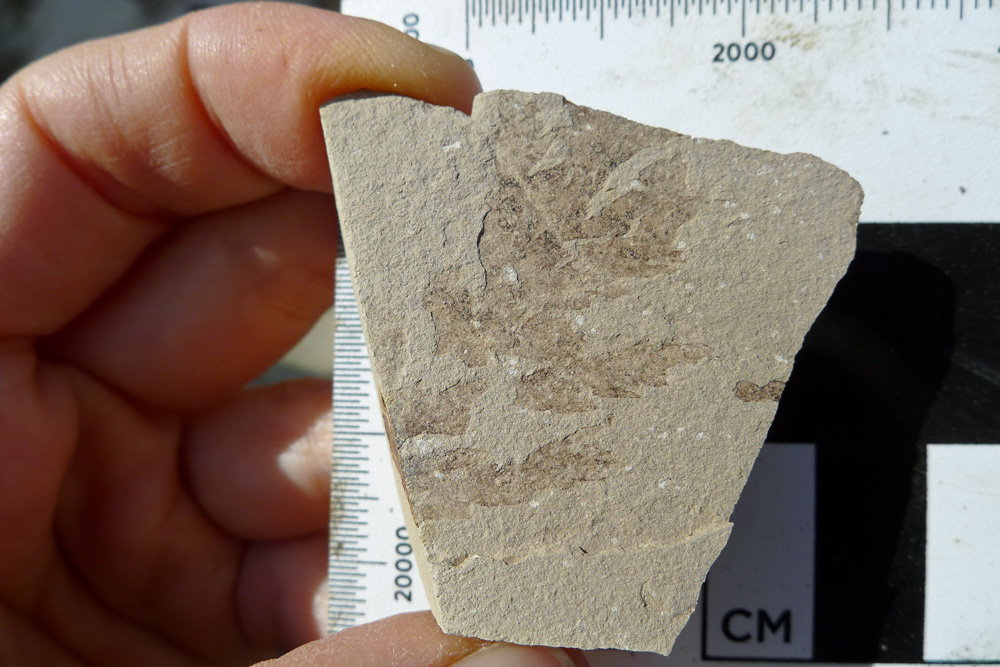
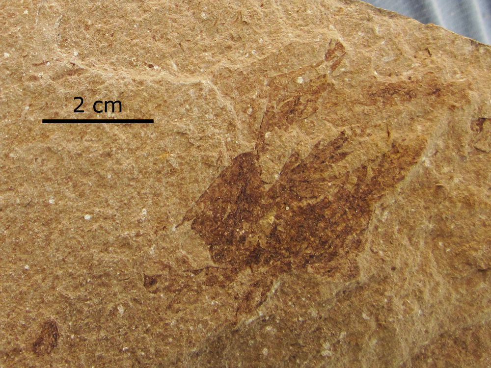
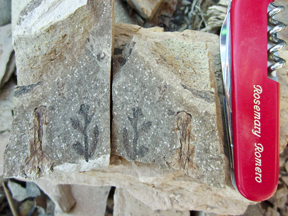
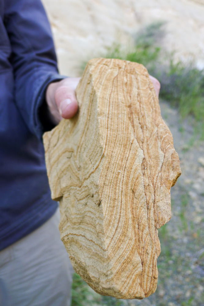
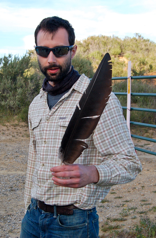
UCMP alum Daniel Axelrod (A.B., 1933; M.A., 1936; Ph.D., 1938) described some plant fossils collected in Piru Gorge in a 1982 paper3 and Seth and Cindy were hoping that we could rediscover some of his localities. After a quick lunch by the cars, we struck off north up the road to explore some likely (and accessible) exposures. Although some evidence of plant fossils was found, we soon came to the conclusion that finding Axelrod's localities would be like finding a needle in a haystack. It was at this point that Renske and Rosemary departed because of other obligations back in the Bay Area. The rest of us returned to the cars and crossed to the east side of I-5. Seth hoped to take us to a locality where Pliocene stromatolites, formed near the eastern shore of the lake occupying Ridge Basin at that time, could be seen. Unfortunately, a gate with multiple padlocks blocked the road, but all was not lost. Backtracking a bit down Old Ridge Route Road, we enjoyed examining road cuts that exhibited some very nice sedimentary structures. Also along the road, an enormous black feather was found — it was assumed to be from a condor, based on size alone. This probably was correct, since the Sespe Condor Sanctuary is located only about ten miles to the southwest.

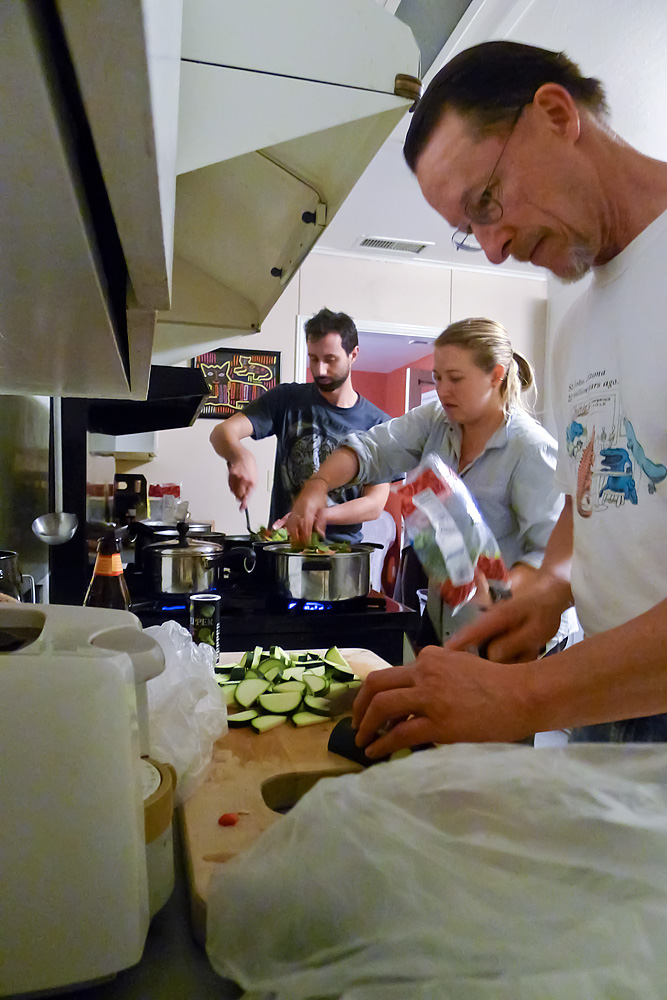
That evening we were to be the guests of Integrative Biology grad student Shawn Shirazi, who generously offered to let us stay at his home in Yorba Linda, just northeast of Anaheim. Getting there meant crossing the Los Angeles basin, known for its many highways choked with slow-moving traffic, but for whatever reason, we were extremely fortunate and encountered few problem areas. Before heading to Shawn's, we all rendezvoused at a mall in Valencia where we had a nice dinner at The Fishtail Grill. From there it was a straight shot to Yorba Linda. Shawn's place was not the kind of lodgings field trip participants are used to (see photo on next page) but the hospitality and showers were most welcome!
1 Surpless, K.D., R.B. Ward, and S.A. Graham. 2007. Evolution and stratigraphic architecture of marine slope gully complexes: Monterey Formation (Miocene), Gaviota Beach, California. Marine and Petroleum Geology 26:269-288.
2 The Golden State Highway, or U.S. Route 99, was one of the first national highways commissioned in 1926. It ran from the Mexican border all the way to Canada, primarily along the present rout of Insterstate 5. Read more about this highway.
3 Axelrod, D.I. 1982. Vegetation and climate during middle Ridge Basin deposition. Pp. 247-252 in J.C. Crowell and M.H. Lisk (eds.), Geologic History of Ridge Basin, Southern California. Pacific Section, Society of Economic Paleontologists and Mineralogists.