|
|
Registration is open for the 2016 Short Course. Please click here for the registration form.
|
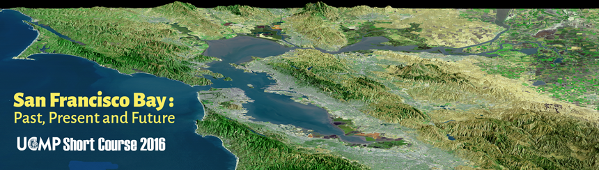
The San Francisco Bay estuary is one of the most important ecological habitats in California and its presence influences most everything unique about the area – the geography, the weather, the people. Earthquakes, sea level change, erosion, and other geological processes have shaped the Bay and surrounding landscape for thousands of years. Today and throughout the history of human settlement in the Bay Area and northern California, the Bay has been affected by human activity in a multitude of ways – from hydraulic mining during the gold rush, the introduction of non-native species, and to the ongoing modification of the Bay shoreline in a region where more than 7 million people call home. Join us to explore the state of the Bay and hear from experts on its history and future as we consider the human and non-human causes of change continuing to shape the San Francisco Bay. This short course is co-sponsored by the Berkeley Natural History Museums (BNHM) and Science@Cal.
Saturday, February 27, 2016 Agenda |
||
|
8:15-9:00 |
Registration |
|
|
9:00-9:10 |
Welcome, logistics, and introduction by Lisa White |
|
|
9:10-9:20 |
Setting the stage — Lisa White |
|
|
9:20-10:10 |
Earthquakes and Faulting: The San Francisco Bay Area's Brahma and Shiva (Builder and Destroyer)
|
|
|
10:20-11:10 |
Clearing waters of San Francisco Bay: A legacy of California's Gold Rush
|
|
|
11:20-12:10 |
A History of California Climate Extremes: Clues from San Francisco Bay Sediments
Download Ingram and Malamud-Roam's Presenation (60.3 MB) |
|
|
12:10-1:20 |
Break for lunch (on your own) |
|
|
1:20-2:10 |
Toxic Phytoplankton: Algae with an Attitude in Northern California
|
|
2:20-3:10 |
Out of the pan, into the fire: Restoring the San Francisco Estuary's tidal wetlands in the face of rapid climate change
Download Vasey's Presentation(63.7 MB) |
|
|
3:10-3:30 |
Open questions |
|
|
About the Speakers David Schoellhamer is a Research Hydrologist for the U.S. Geological Survey. He has studied sediment transport in San Francisco Bay since 1993. The foundation of this research is a 24 year long database of automatically and continuously collected suspended sediment data. Initially his research was on tidal variations but as the database lengthened longer time scales and geomorphology had to be considered to understand the data. He has advised many marsh restoration projects in the Bay Area. He earned a Bachelor and Master degrees in Civil Engineering from UC Davis and a doctorate in Coastal and Oceanographic Engineering from the University of Florida. B. Lynn Ingram is a Professor in the Departments of Earth and Planetary Science and Geography at UC Berkeley. She studies the history of climate and environmental change in California using sediment cores from lakes and estuaries, including San Francisco Bay. A Fellow of the California Academy of Sciences, a Senior Fulbright recipient, and Miller Fellow at UC Berkeley, Lynn is the author of more than sixty published scientific articles on past climate change in California and the Pacific Rim, including The West without Water: What Past Floods, Droughts, and Other Climatic Clues Tell Us About Tomorrow (2013, UC Press) Frances Malamud-Roam is a Senior Environmental Planner and Biologist at Caltrans. She received her B.A., M.A. and Ph.D in the Department of Geography at UC Berkeley, with research expertise in the origin of agriculture in China, the long-term evolution of salt marshes and estuaries along the Pacific Coast, and changing climate in California and the West. She has taught earth science and physical geography at Sonoma State University and Laney College. Frances is co-author with Lynn Ingram on The West without Water: What Past Floods, Droughts, and Other Climatic Clues Tell Us About Tomorrow (2013, UC Press) William Cochlan is a Senior Research Scientist at the Romberg Tiburon Center for Environmental Studies at San Francisco State University. He is a phytoplankton physiological ecologist who has conducted research as varied as large-scale oceanic iron fertilization studies in the equatorial and northern Pacific and Southern Oceans to designing and optimizing the commercial technology for algal biofuel production. A veteran of many multi-partner research efforts including ecological studies in the Southern Ocean, Harmful Algal Blooms in the Salish Sea and San Francisco Bay, and the impact of ocean acidification along the California coast, Bill is currently studying the effects of climate change on phytoplankton physiology and biotoxin production. Bill earned his B.Sc. and Ph.D. at the University of British Columbia, and his M.Sc. from Dalhousie University. Michael Vasey is an evolutionary ecologist by training and a long-time lecturer in conservation biology at San Francisco State University. He helped found the SF Bay National Estuarine Research Reserve (NERR) and conducted several years of research focused on tidal wetland vegetation in the San Francisco Estuary (SFE). The emerging focus of the NERR is coastal resilience, coastal intelligence, and engaging diverse audiences to better appreciate and support conservation of the SFE. As Director of the NERR, Mike manages a small dedicated staff focused on long-term monitoring and research, native oyster research, research on sediment transport across tidal marshes, teacher education on estuarine issues and citizen science (such as the King Tides Initiative), and coastal training workshops focused on climate change adaptation.
NOTE: Parking is always a problem on and near the campus. We strongly recommend taking public transportation. If this is not possible, public parking in the campus vicinity is indicated on this two-page pdf. Questions? Contact Lisa White. Read about past UCMP short courses. San Francisco Bay graphic adapted from SFBayQuakes.org. |
||